Easter in Glenbrittle, Isle of Skye

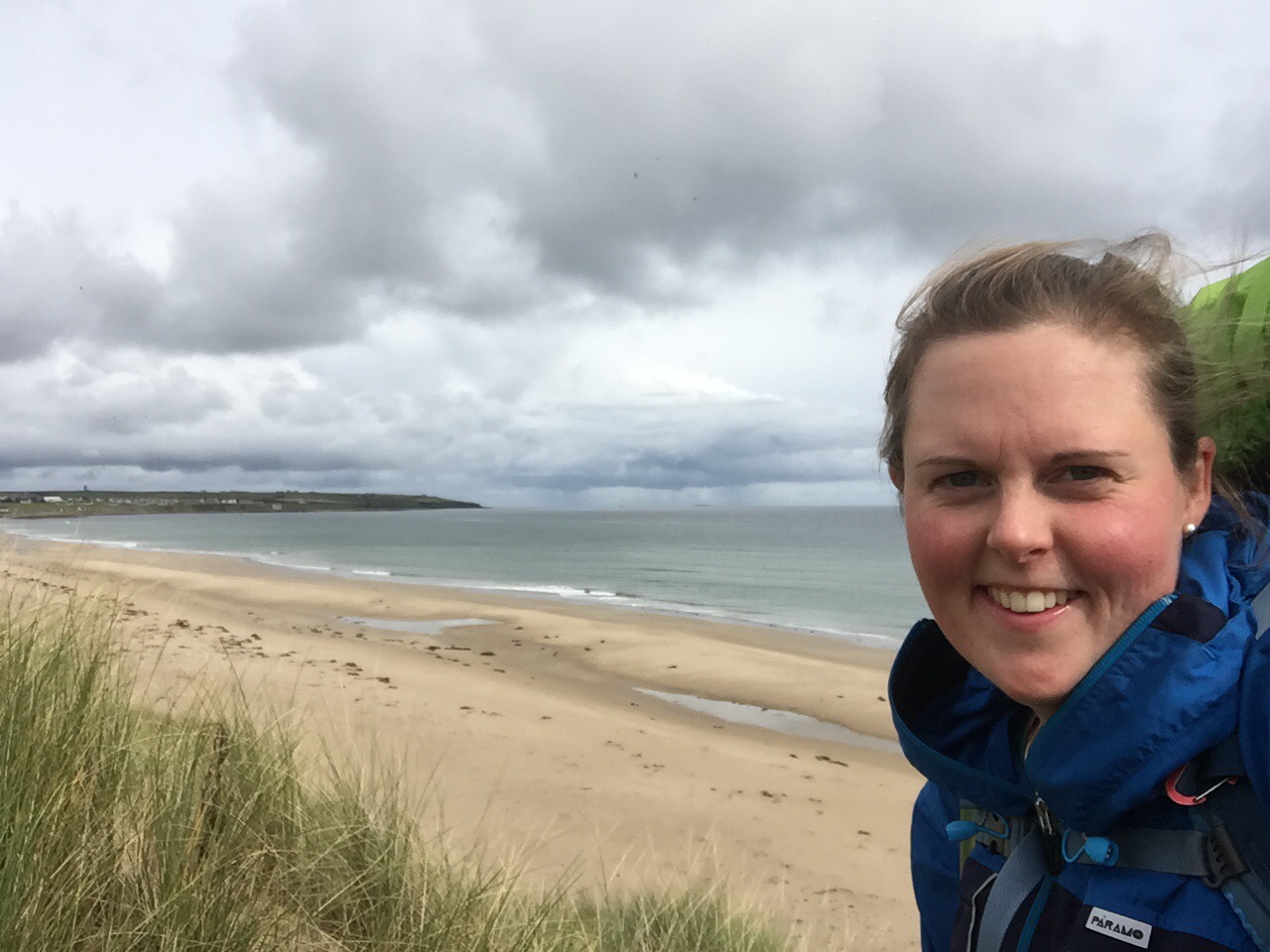
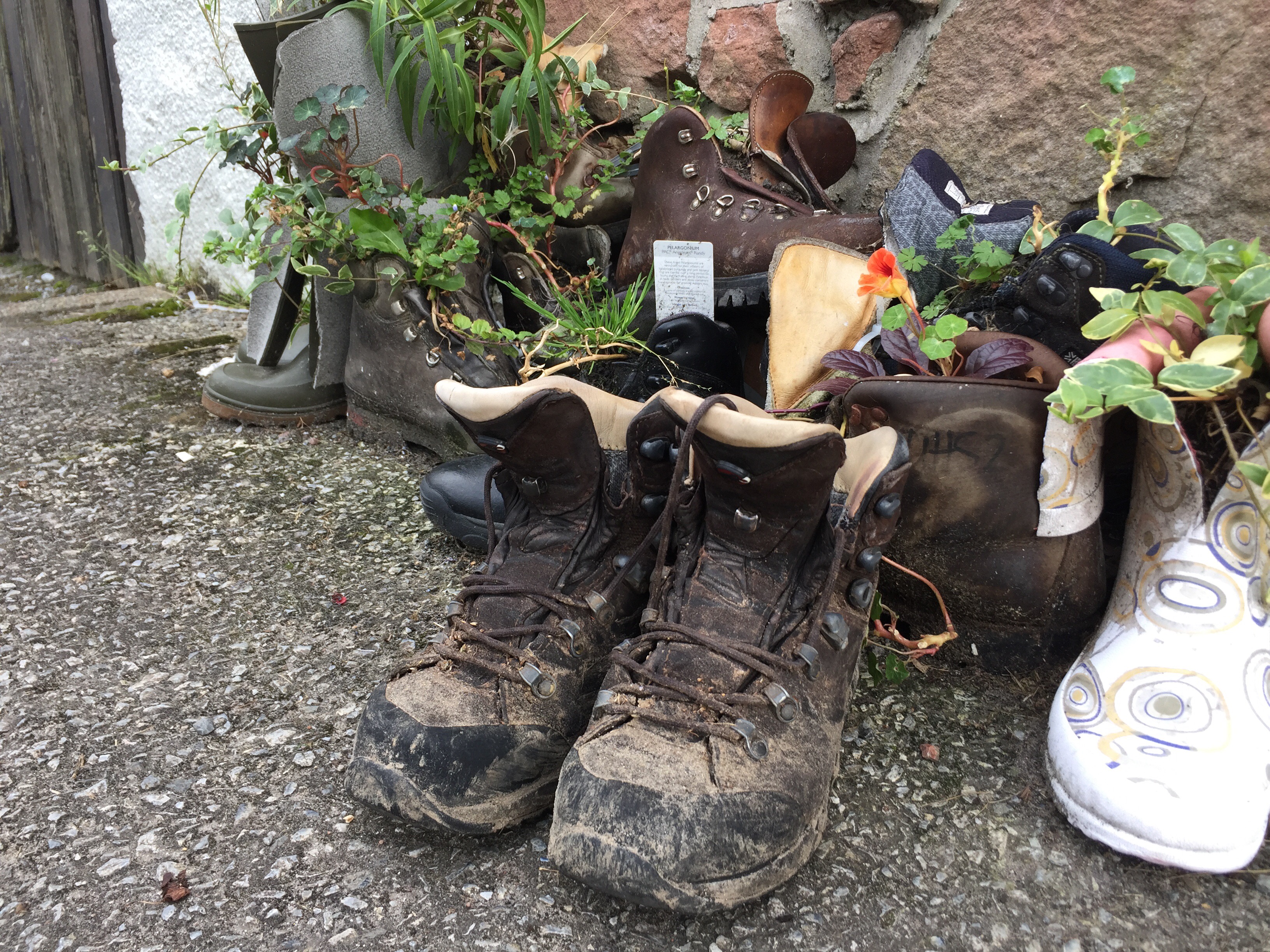
Whilst most people tied up loose ends at work before the Easter weekend I took a flight to Inverness with Rob and Liz, hired a car and soon found ourselves in the remote Highlands on our way to Skye. In search of dinner we stopped at Ledgowen Hotel which due to lack of trade had closed the kitchen early so we drove round the hills to Kinlochewe Hotel where they had also stopped serving but were able to construct 3 sandwiches. Not the haggis, neeps and tatties we’d been fantasising about, but it was that or go to bed hungry. We arrived at Gerry’s Hostel around 9:30pm. After the tour we put a record on the turntable and imbibed a dram of whiskey by the roaring fire – we’d arrived in Scotland!

Day 1 – Good Friday 30th March
Peaks – Carn Odhar
Companions – Rob and Liz
Distance – 5.8mi (9.3km)
Ascent – 1660 ft (506m)
Pubs – none

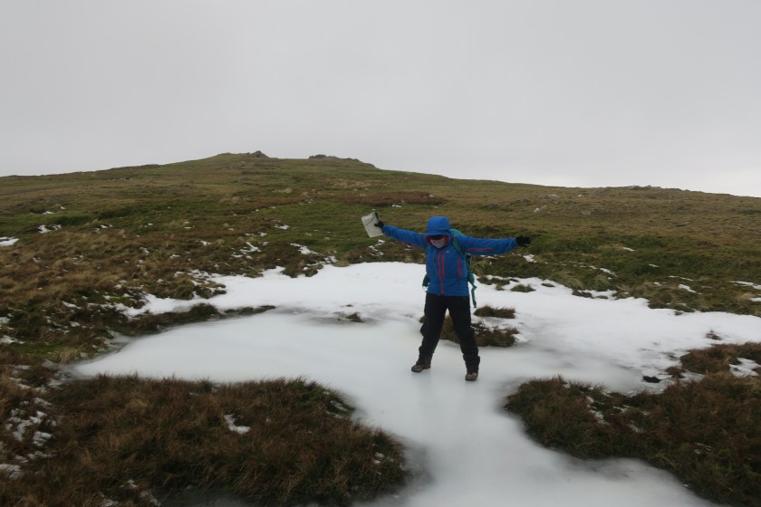
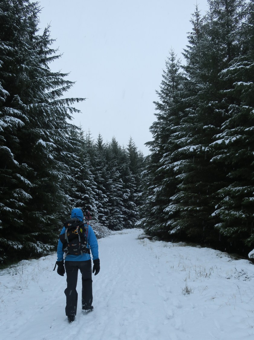
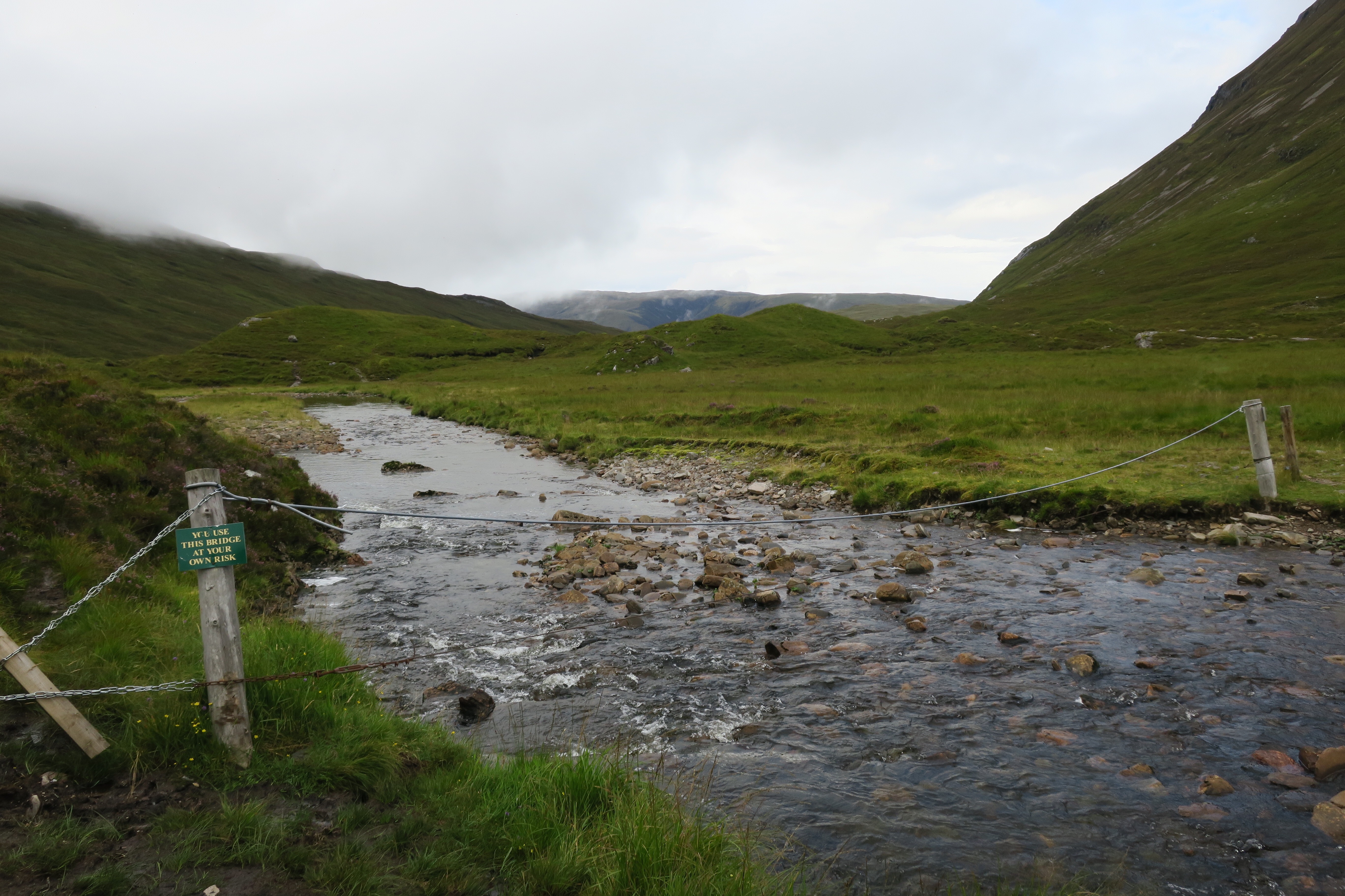
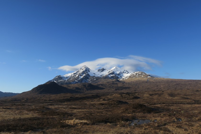
We weren’t able to check in at the Skye hostel until later in the afternoon so planned to do a local walk near the hostel. We left the car at Achnashellach station, walked over the level crossing and headed up the forestry track. The views up and down Lochcarron were stunning. Looking east were snow capped mountains, looking west was the loch and onward views towards Skye. For a brief stint we were retracing the route that I took on my LEJOG walk – I tried not to bore my walking companions with commentary; ‘ooh when I was here I stopped at that rock for some sandwiches’! We turned off the forestry track and struck out across a pathless bog up to the top of Carn Odhar and soaked up the views of the Beinn Liath Mhór, Sgorr Ruadh and Fuar Tholl in dappled sun.

30492464_Unknown
The very photogenic mountain range

We descended to the west avoiding crags and scree, and met an established path leading down to the forest and the station. It was a pleasant stroll and a good appetiser before the main course on Skye.

Day 2 – Saturday 31st March
Peaks – Bealach Coire na Banachdich
Companions – Kevin, Rob and Lisa
Distance – 5.8mi (9.3km)
Ascent – 2808ft (856m)
Pubs – none

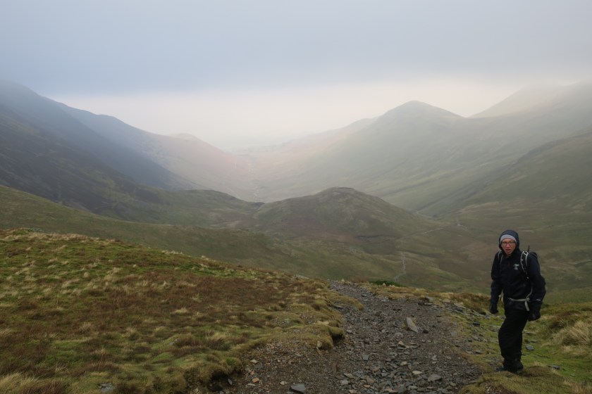
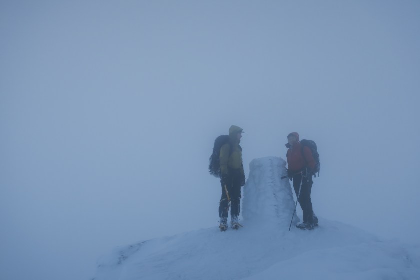
With the weather due to be settled for the whole day the majority of Rockhoppers set off early for the Cuillin ridge. Not being a climber or experienced winter hill walker my only ambition in the current winter conditions was to reach the ridge and 3 others shared this aim so off we went. The walk started a short stroll down the valley beyond the Mountain Rescue Hut and would be in three distinct sections; a long gentle path up the first 300m of vertical ascent, the middle 300m ascent would be steeper and involve some scrambling and the last section would be on steep hard snow/ice.

30492576_Unknown
Section 2 on the way up Coire na Banachdich
30492624_Unknown
Rob on the last section

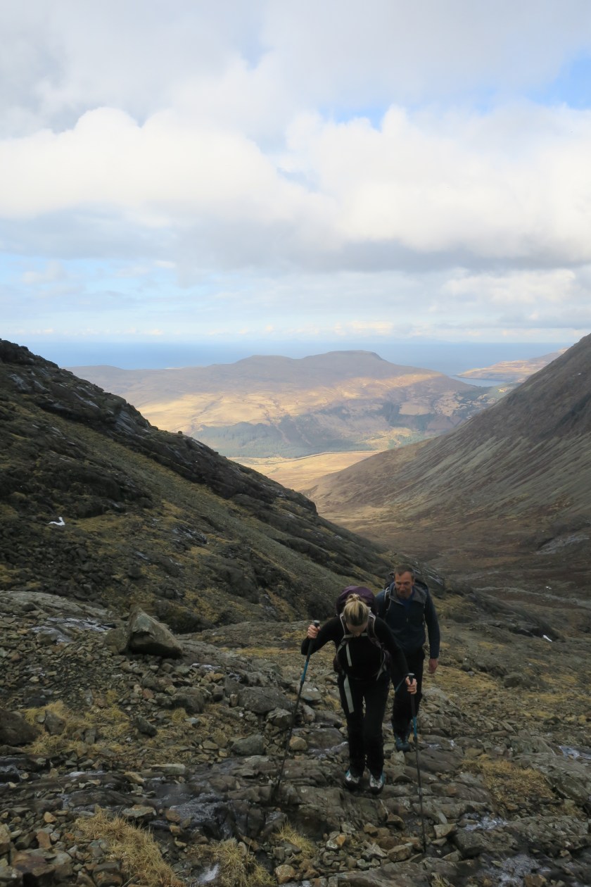
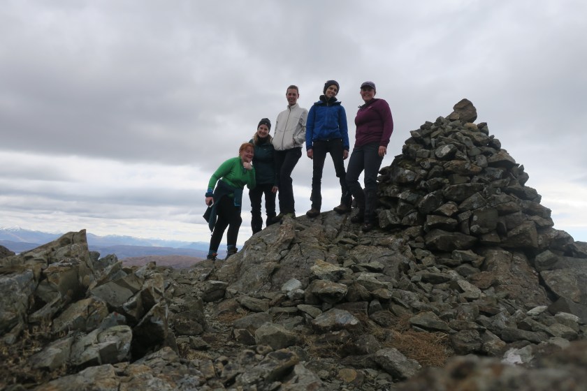
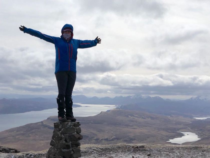
It all went to plan and sporting crampons and ice axes we reached the bealach shortly after noon just as the cloud lifted off the tops.  The bealach was narrow and potentially corniced so we made a relatively quick decision that as a group we had reached our limits. After a couple of photos we started descending the way we had come. I was not at all dispirited, I had made it to the Cuillin ridge in winter – an achievement not to be underestimated. Highlights included; the waterfall, the view from the bealach and returning to the base of the snowline unscathed!

30492704_Unknown
View over the bealach

We were back at the hostel in plenty of time to relax, have tea and cake (or beer and crisps) before the majority arrived back. When they did, the usual cacophony erupted with everyone sharing tales of the day. There had been 9 Rockhoppers on the In. Pinn. at once – could that be a record?!

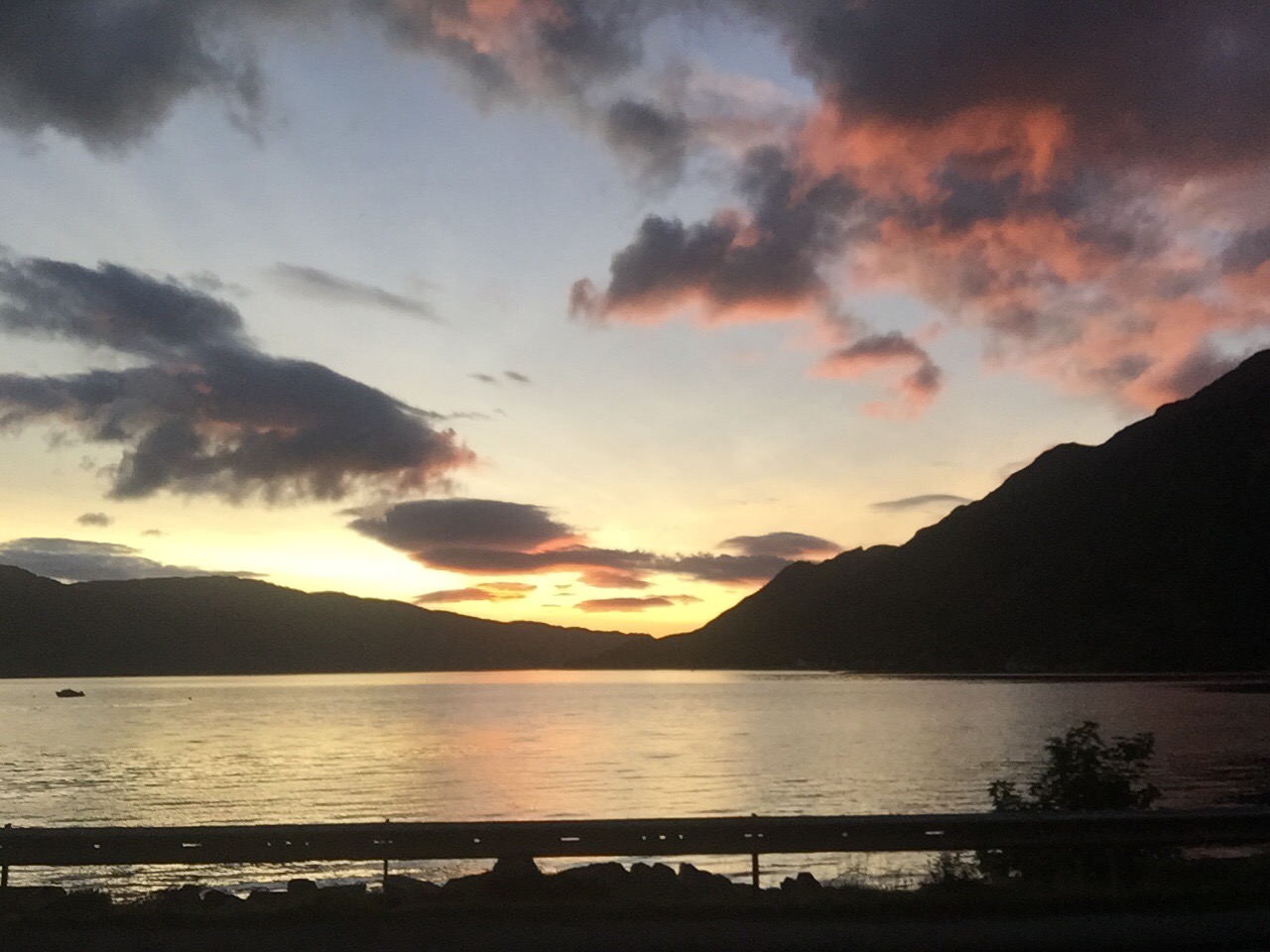
In the evening a few of us drove up the valley to watch the sun set over the Cuillin – well worth it!

30493344_Unknown
Sunset on the Cuillin

Day 3 – Easter Sunday 1st April
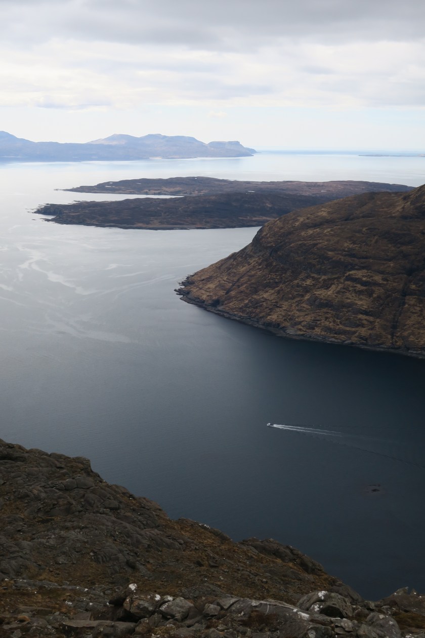
Peaks – Sgurr na Stri
Companions – Lisa, Catherine, Giulia and Anne
Distance – 15.1mi (24.3km)
Ascent –  2414ft (736m)
Pubs – Sligachan Hotel

For some, the Cuillin is their playground so off they went to tackle it again, I would be satisfied with a longer and lower walk.  It had been a cold night with a hard frost right down to the valley so it required some time and effort to clear the windscreens. Sgurr na Stri is a modest hill (494m) and a well known beauty spot which provides fantastic views of the Cuillin and the sea loch at it’s base which leads the eye out to Rum. We started at the Sligachan Hotel which was crawling with visitors and tour buses but the crowds were soon behind us.  Luckily the 7mile walk-in puts off a large number of tourists!

30755536_Unknown
Cloud capped Cuillin

It was a glorious morning; t-shirt weather. We passed a few people on their way out who had camped at Sgurr na Stri but didn’t see anyone else until we reached the top when a group of a dozen plus a few others emerged.  I thought we’d have the place to ourselves but it was like Piccadilly Circus up there! And for good reason.  It feels very remote, rugged and the views are stunning.

30755728_Unknown
View from Sgurr na Stri

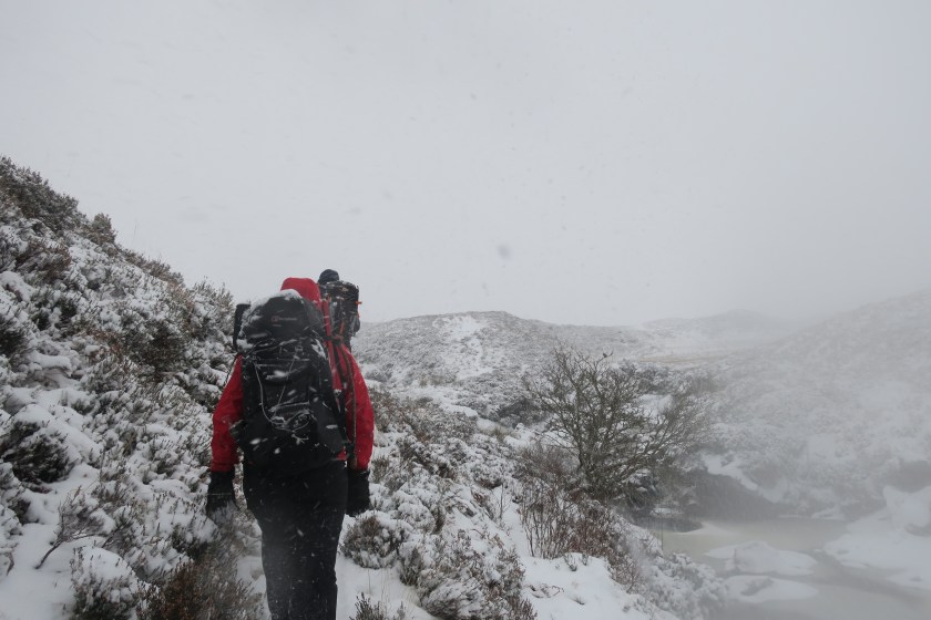
After a few snaps and snacks we began the walk back and who should we bump into? Only Marcus – another Rockhopper who spent Easter on Raasay and was backpacking around Skye independently.  As we were catching up it starting spitting and then raining/sleeting so we said goodbye and set off for the pub! It rained for about 20mins but then the sun came back out – fours seasons in one day!

30755744_Unknown
Atop Sgurr na Stri

Day 4 – Easter Monday 2nd April
Peaks – The Storr and Quiraing
Companions – Rob, Lisa and Simon
Distance – 7.5mi (12km)
Ascent – 2688ft (819m)
Pubs – none

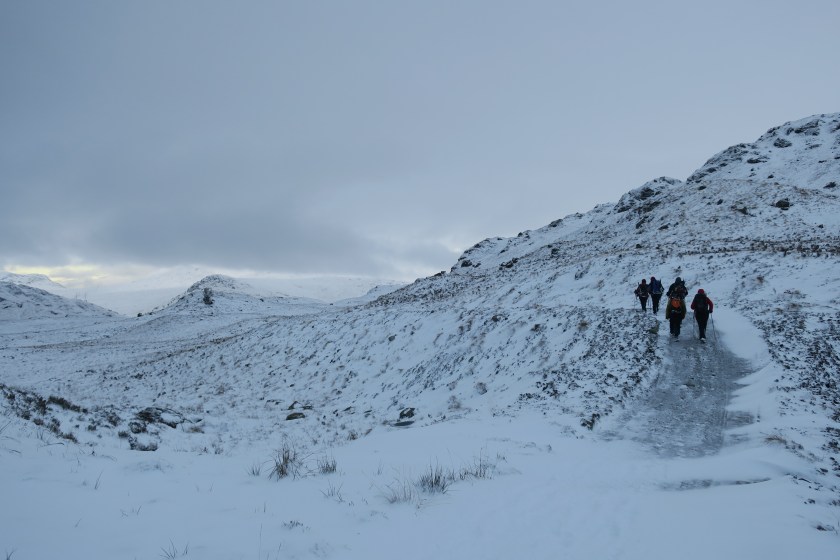
It was a relatively lazy morning and by mid-morning Rob, Lisa, Simon and I had decided to totter off to Trotternish to hit some of the Skye tourist hot spots; The Old Man of Storr and the Quiraing.  It’s a stiff climb up from the car park to the base of the needle-like structure (to around 450m) and the path is crawling with visitors in jeans and trainers.  We feel a little over prepared in hiking boots with ice axes and crampons strapped to our rucksacks, but could be vindicated when we reach The Storr – the hill that looms over the Old Man.

30756080_Unknown
The Old Man of Storr and The Storr

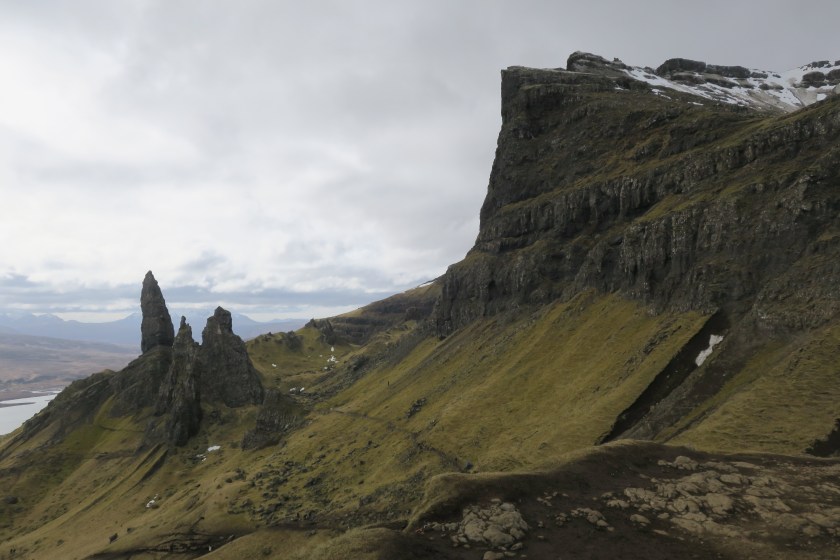
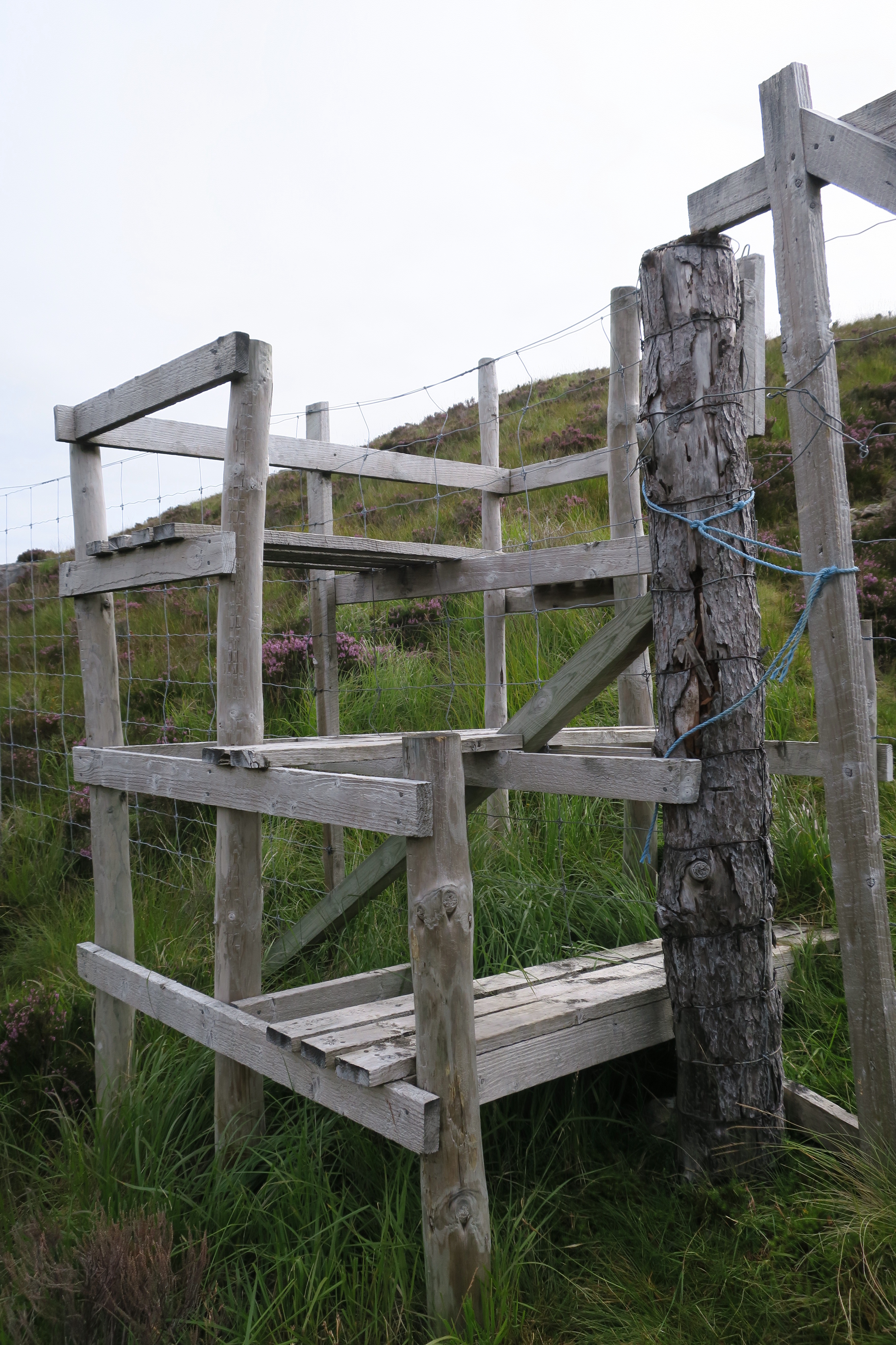
There is a clear line – a fence and stile – which few tourists venture beyond, when we do we turn west, and the wind and wind chill pick up.  Extra layers adorned we opt for the long route to the top. About halfway up the ground became frozen with small snow patches but it’s still easily passable.

6a41719d-8ec1-4da5-8e7f-2be21e6dc61a
Me on the Storr

Strong and cold winds meant we didn’t hang about much longer than the time it took to inhale a sandwich. On descending, we overshot the burn but not by much and after scrambling down the gorge we were soon back at the base of the cliffs. Once back to the car we drove further north to the see the Quiraing.  If you park at the top of the ridge it’s only 1-2km along a terraced path to the other worldly rock features. To me the Trotternish ridge looks like a series of waves that are just about to break – gentle rolling grass slopes to the west, cliffs (or wave crests) facing east.

30756480_Unknown
View of the Trotternish Ridge from the Quiraing

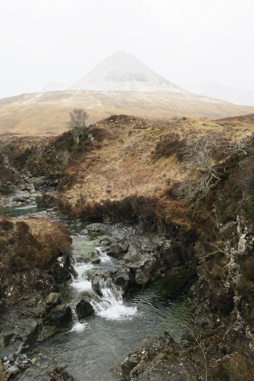
And that concludes a rather fantastic Easter weekend on Skye, oh except a brief wander up the cascade of waterfalls opposite the hostel on the last morning. The clear pools would be refreshing on a summers day (some crazy people had been for a dip) but I wasn’t prepared to find out quite how cold the water was, I’ll save that for another time.

30756544_Unknown
Not the Fairy Pools

Total: 4 days, 34.2 miles, 9570 feet of ascent and 1 pub.

Grange, Borrowdale, Jan 2018

The drive up was smooth (made a nice change, my usual experience of driving to the Lakes involves a lot of stand still traffic) and all 15 of us more or less arrived together. We were staying at the Climbers’ Club hut which usually has spare beds for members, but we’d booked all 13 (+2 campers). We arrived around midnight and after we’d been crashing about for a while a sleepy and bashful looking guy came downstairs and apologised for not having checked the roster so Dayne volunteered to sleep on the sofa, quickly defusing the situation.

Day 1 – Saturday 13th Jan
Peaks – Maiden Moor, High Spy, Dale Head, Hindscarth, Robinson
Companions – Kevin, Katrina, Rob, Alfonso, Monica
Distance – 9.6mi (15.5km)
Ascent – 3,736ft (1,140m)
Pubs – Swinside Inn and Scafell Hotel walkers bar

Most awoke early and got on with getting ready to head out (I was last up at 8:30) but I was extremely organised on Thursday night and had not only planned my food for the weekend but already made up my lunch so knew I could afford to be a bit lazy. Over breakfast plans were made; one group were off to find some ice to climb, another up to the top of England, a couple of individuals wanted to walk alone and the rest of us decided on the nearby Newlands Horseshoe (minus Catbells). We drove to Little Town and then headed up to the col between Catbells and Bull Crag. The ascent was initially very sheltered but the wind picked up a little once we were on the tops. The view across Derwent Water up towards Keswick was stunning, with just a small amount of low, thin cloud – much better than expected.

29966928_Unknown
View along Derwent Water

We continued up to Bull Crag, stopping briefly behind a crag for some refreshments. All was still and quiet until we peeled ourselves away and got out from behind the rocks where the head wind blasted us. It wasn’t overwhelming so we pushed on up to High Spy and down the other side towards Dalehead Tarn. Unfortunately it was here that Monica and Alfonso decided to take the escape route down from the tarn back towards Little Town. We’d see them back at the hut later. Six became four and we had to climb the staircase up to Dale Head. The views back to High Spy took us by surprise, from here it looked like a long dramatic ridge but whilst up there it felt reasonably short and rounded. We walked into cloud but it was relatively thin and there were breaks, and the wind picked up briefly but it was still manageable.

29967120_Unknown
Team at the top

The rest of the ridge was straightforward and we decided to make the diversion up to Hindscarth and back, with a lunch stop en route with my new favourite hot toddy: lemon and ginger tea with whiskey. The last climb was up to Robinson and my legs were starting to feel a bit heavy. At the top we had a new set of views. All the way along this walk we had new views at every corner which made it even more enjoyable. Up here some pools of water had frozen absolutely solid and it was possible to walk on them, and glide around. Standing in a star shape with my back to the wind I got nudged across the ice by the wind!

29967168_Unknown
Walking on water

Now for the decent, not a long valley decent but a short sharp – part scramble – down the nose. We happened to take the route back to the hut which took us past the Swinside Inn so we thought it would be rude not to stop by for a swift libation (soft for me as I’m doing dry-ish January; no beer or wine). Later on in the evening we returned to a regular haunt; the walkers bar at the Scafell Hotel in Rosthwaite. It appears to have changed hands, the walls have been painted, the ‘look’ refreshed and the menu re-written. Unfortunately it’s changed for the worse, it appears that another traditional pub has bitten the dust and turned ‘gastro’. Sigh.

Day 2 – Sunday 14th Jan
Peaks – Grisedale Pike
Companions – Kevin, Alfonso, Monica
Distance – 7.2mi (11.6km)
Ascent – 2,897ft (885m)
Pubs – none ☹️

Car packed and goodbyes said (weekends go too quickly), Rob who had work to do, dropped us in Braithwaite on his way to a coffee shop in Keswick. We set off with the vague intention to bag Grisedale Pike, Hopegill Head and Sand Hill. It was a long and relentless ascent and I was certainly feeling slightly leaden booted after yesterday as we marched up the side of the hill. The further we went the colder it got, the windier, wetter, snowier and cloudier it got. Plus the terrain got a bit more challenging. It changed from a broad grassy track to a narrow, rock and slate path. Towards the very top the ground was also becoming frozen.

29967312_Unknown
Another view of Derwent

Once we reached the summit the wind was blasting the hail into our faces (when a fleck hit you right in the eye it did sting a touch), the visibility was poor and it was cold. Needless to say we didn’t hang about and continued on. Part way to the col we decided that the weather was taking the fun out of it so we cut across the lower slopes of Sand Hill to skip out the remaining two peaks. As soon as we started to descend the weather improved and we had great views down the valley.

29967504_Unknown
Kevin on the way back down

It was an interesting route back to Braithwaite with waterfalls and a disused quarry. Rob’s timing was perfect so we all hopped straight in the car and hit the road back to London.

Total: 2 days, 16.8 miles, 6,633 feet of ascent and 2 pubs.

Walking in a Winter Wonderland

Having completed a rather large walk this summer (see: LEJOG final day) I took a brief hiatus from my blog, but not walking.  I’ve already been on a couple of Rockhopper trips since landing back in the real world; Cheddar and the Brecon Beacons, but what with moving house and starting a new job I didn’t find the time to write up the notes.  But now it’s 2018, so a new year and a new motto; “to upload blog reports after each trip”.

Every New Year, the Rockhoppers peel themselves out of their respective Christmas armchairs, arouse themselves from their turkey stupors and head to Scotland to work off the extra mince pies.  Crianlarich was this years destination.

Day 1 – 28th Dec 2017 – Grasmere
Peaks – Stone Arthur, Great Rigg, Fairfield
Companions – Rob, Ellen, Christopher
Length (mi) – 6.5
Ascent (m) – 1102
Pubs – Traveller’s Rest

A fully laden car-load of us arranged to travel up via Grasmere and so after stocking up at the local Booths we checked into the YHA.  First thing in the morning we re-packed the car ‘tetris-style’ and parked up on the main road. There was an air of excitement as we set off in the direction of the snow on the tops of the fells. It was a stiff climb up out of the valley and onto Stone Arthur but once up there it was the views what took my breath away not the effort of heaving myself up. Crisp white snow, blue sky with fluffy white clouds, and the sun bouncing off the ribbon-like rivers and sprawling lakes.

29703248_Unknown
View towards High Raise and Ullscarf

We had a brief attempt at a snowball fight and then continued up onto Great Rigg where we met the hoards coming from Heron Pike – the more orthodox way to reach Fairfield. We hunkered down in the shelter for a quick lunch and then started to descend to Grisedale Hause. The start of the path was fine but as it got steeper and rockier and the snow had been compacted by those coming up, it was too icy. Crampons on and walking like John Wayne we negotiated the rest of the steepish descent.

29703488_unknown.jpg
Onwards towards Fairfield

Once we were virtually at the bottom and after a few slips (mostly by Ellen), we accidentally took a slightly wrong turn that meant we had to walk past a pub to get to the car. Before long we were supping beverages in the warmth of the pub and looking forward to the next part of the trip. If this was the hors d’oeuvre I was very much looking forward to the main course. Crianlarich here we come!

Day 2 – 29th Dec 2017 – Inverarnan
Peaks – Beinn Chabhair
Companions – Rob, Ellen, Pete, Johnski, Dave, Alison, Bruce, Rachel, Daniel, Rachel and Florrie
Length (mi) – 9
Ascent (m) – 1107
Pubs – Drover’s Arms

With poor weather forecast a large group of us decide to head to Beinn Chabhair where we think we’ll be sheltered for most of the day. It’s an out and back trip, not my favourite, but around here the circuits are very big days that require good weather and/or long days. Neither of which we have today.  It was touch and go as to whether all the cars would get out of the icy hostel car park, or along the road (we pass an incident where a car has left the road and lay resting in the ditch, there was already plenty of assistance on scene so we don’t sop). Eventually we gather at the Drover’s Inn and set off through the Beinglas campsite.  It looks very different to when I stayed here in August whilst I was on the West Highland Way. Back then it was a hive of activity, absolutely crammed full of campers, hikers and music streaming out of tents/mini-marquees. Today it is deserted, snow covered and the contrast is a bit eerie.

29703792_Unknown
The plateau

We slip and slide up the side of Ben Glas Burn, soon reaching the plateau with a substantial track and seek out the lochan at the end of which we’ll turn away up and away from it. On the plateau we try to avoid the bogs which are disguised under the snow but a couple of us unintentionally find them. I myself experience an unpleasant trip into a bog. I’m following about five other people in single file along the path when my left foot somehow finds a hole about a foot deep. All of a sudden I’m sat on the ground trying to wrench my foot out which I fail to do. Someone reaches over and yanks my leg releasing my foot from the cold, wet quagmire and in my haste to get up off the ground I swivel and inadvertently plunge my right foot into the cold depths. D’oh! My boots and gaiters do their job and keep most of the water at bay.

29703872_unknown.jpg
Snowie selfie!

We weave our way up steep gullies filled with snow about knee deep, and the going is slow. It’s like walking up a very unstable sand dune; the soft powdery snow gives way to uneven tussocky ground and sometimes ice underneath. Although we can’t see the top, we know we’ve reached the ridgeline and that the summit is nearby.  The wind funnels across the mini-col bringing the wind chill down significantly (the forecast was for -10 to -15’C on the tops) so we don’t hang around for long as time is running out. We quickly strike out for the top, reach it and then turn around to retrace our steps. 

Going down is far easier, the snow feels soft and forgiving, although we all know that hard rock shaped objects lurk beneath the pristine coating.  A couple of gullies are ripe for bum-sliding which a few of us enjoy.  On one occasion, I was about halfway down and the congestion at the bottom still hadn’t cleared, I was picking up pace and then a deep trench on the left comes into view. I try to hit the brakes and steer myself right but I become unstable and roll on to my right.  My right shin/knee then finds one of the buried rocks and I tumble in the snow.  I get up, luckily it’s not serious but it was a hefty clunk and my knee is sore. I limp on down, it soon eases and within what feels like no time at all, we’re back at the lochan (I managed to avoid the hole I found on the way up, unfortunately someone else found it).

29703984_Unknown
Taking the track back

Back at the track, the group divides, some head back down the steep burn-side path, some take the track. I opt for the track as the walking is easier on my sore knee, and then proceed to slip on the ice and bruise my other knee. Despite this, my pace quickens as I can almost taste the local ale and smell the wood smoke. It’s an eccentric pub, stuffed with taxidermy at every turn and I dine on a burger with haggis, scrummy!

A great day out and my first winter munro – a baptism of snow and ice, followed by boots drying by the fire.

Day 3 – 30th Dec 2017 – Tyndrum
Peaks – Sron nan Colan, Meall Odhar
Companions – Rob
Length (mi) – 7
Ascent (m) – 662
Pubs – Real Food Café

After yesterday I’m up for a slightly shorter day, as is Rob, so we head to the cafe in Tyndrum for breakfast – I decide that I’ve not had enough of the Scottish meats so I go for the full Scottish breakfast with sausages, bacon, black pudding, lorne sausage, plus potato cake, beans and mushrooms. Full of breakfast we head out across the railway line, initially contour around the base of the hill until we head straight up the side.  There are lots of deer tracks crossing the path but no sign of any deer, or any other wildlife for that matter, I think it’s too cold for most things.  Low down there is a distinct path but we lose it under the snow so we head off-piste but generally head to our right as there are disused mine shafts to our left.  There are occasional breaks in the cloud that allow us to view the base of the valley from the hillside.  At the top we spot a partridge and the way ahead is laid out by old posts of a border fence.

We wander around this mini-ridge and are soon atop Meall Odhar where we stop for a quick bite and a hot toddy – I remembered to bring my hip flask with me today and discover that lemon and ginger tea with whiskey is delicious! We look down on the forest below and there is no obvious route so we meander through the trees – it’s a proper winter wonderland – and there are deer tracks aplenty. We pause to make a snowman, the classic way, by rolling 2 balls of snow down the hill, furnish him with twigs for arms and fern tips for eyes and mouth.  He looks a bit like E.T. crossed with No.5 from Short Circuit!

29704240_unknown.jpg
Snowman!

We continue down and just before reaching the edge of the forest a deer scampers off through the trees just a few metres away.  Below the trees a large new deer fence (with no stile or gate to be seen miles) is overcome and we meet a track that leads up the valley to Ben Lui.  No time for that today, so we turn down the valley, returning into the forest and to the level crossing at Tyndrum back to the cafe!

29704320_unknown.jpg
Wintery forest


New Year’s Eve

Unbeknownst to me I barely sleep the night before and since Storm Dylan is forecast to pass over today I opt to spend a day in the hostel along with half a dozen others. I felt very snug and smug staring out at the rain lashing against the windows and the wind swaying the trees. I know I’d rather be sat by the fire reading a book today and looking after Fury the dog, than being out on the hill.  In the afternoon it’s time to starting peeling potatoes, turnips and apples in order to serve up haggis, neeps, tatties with gravy and apple crumble for 35 hungry ‘hoppers – a recent new year’s eve tradition. After dinner, a few fireworks, drinks and games we wander down to the local pub to see in 2018.  Most of us are tucked up in bed by 1am in order to get up and head back out on the hill the following day.

Day 4 – 1st Jan 2018 – Crianlarich
Peaks – Ben More
Companions – Florrie, Ellen (& Rob sort of)
Length (mi) – 7.3
Ascent (m) – 1146
Pubs – None

It’s a more leisurely start this morning and we’re walking by 10, but we don’t have a long route planned. Up Ben More, over the top, down to the bealach, into the valley and then follow the track back.  It’s raining as we start and after ascending via a track, we turn up the muddy hillside where soon the ground and air are filled with snow.  It’s here that Rob decides that a niggle he’s got is too sore to continue, so off he goes and takes his car with him but he offers to come and pick us up once we’re finished.

Visibility is poor but we’re sheltered from the worst of the wind and we gently zig-zag our way up.  After a quick stop we spot the tracks of an individual who’s about an hour ahead of us so we use them as a guide through the uneven terrain.  Soon we’re amongst icy rocks and I must admit that looking around and down, my knees wobbled slightly. If you were to slip it looked as though there wasn’t a lot to stop you.  Logic told me I would stop because the ground and snow were mostly soft and not sheer but even so I felt exposed.  It was time to don the crampons, after which I felt much more secure.  We eventually reach the plateau when 4 figures appeared from our left – they’d come up the more exposed NE ridge and look chilled to the bone.  We wished them a happy new year, stood by the trig point for the briefest of moments, took a bearing and headed off towards Bealach-eadardh-Bheinn.

29966672_Unknown
Summit of Ben More

We reach the bealach and turn down towards the valley.  The lone walker ahead of us appears from behind; he’s been up and bagged Stob Binnein (we’ll have to come back another day!).  We’re steadily descending but then find ourselves amongst about the only crags on this side of the hill.  Florrie is in front, takes a sideways step and the snow gives way.  She slides down the rock and comes to stop about 3-5m below in a mound of snow, she used her ice axe but I’m not sure it helped her much in this soft snow.  I decide to turn and face the hill but there isn’t enough texture in the rock for the front spikes of my crampons to grip on to.  I try to step down, but I know the inevitable is coming.  I take one more small step and then slip, also sliding to a gentle stop. Ellen tries to pick an alternative route and gets a meter or two lower but also slides down.  We stand up, brush ourselves off and I’m relieved that we’re all ok. Our falls were not significant enough to cause serious injury however even a minor injury to one of us in this spot could’ve changed the dynamic of the afternoon.

29966816_Unknown
Miror loch at the bottom of Ben More

As we approach the road, dusk is falling and we begin to walk back to the hostel saving Rob the trip out.  With less than 1km to go he pulls up and picks us up anyway, I’m secretly glad that there was a breakdown in communication as I wasn’t looking forward to walking the rest of the way on the busy road in the dark. That evening the feeling within in the hostel is more subdued, no-one is pouring over maps and guidebooks, wide-eyed at the opportunities that this landscape presents.  Instead it’s about how early people are setting off for the long drive home.

Total: 4 days, 29.8 miles, 4,017m of ascent and 2 pubs.

The Shetland Islands

Wednesday 20th September
Lerwick, Shetland

IMG_0001
Arriving into Lerwick at 7am

Arrived into Lerwick on a glorious morning and it was a pleasant surprise to be able to check into my B&B; having booked it just hours ago and it only being 8am. After a visit to the tourist information and a coffee I set off on a self-guided walking tour of Lerwick.  It took in all the sights, doing a full lap of Britain’s most northerly town in just a few miles.  I walked around the informative museum learning about Shetland’s geology, it’s Neolithic significance, the Viking invasion and colonisation, the pawning of Shetland to Scotland as part of a dowry, the Dutch herring trade, Fair Isle knitwear, their role in the world wars and the Shetland ‘bus’, traditions such as Up Helly Aa right up to the impact that finding North Sea oil has had.

IMG_0002
Jimmy Perez’s Lodberry off of the Shetland TV show

Shetland has a distinct feel to it, it has a tangible identity and Scandinavian feel, unlike the Orkneys which feel much more like mainland Scotland.  It’s relative distance no doubt contributes to it’s isolated feel. I’ll now not be so crass as to lump them together as one group of islands off the north coast of Scotland, they’re practically 2 different countries separated by approx. 100 miles of sea (with little Fair Isle sat in the middle!).


Thursday 21st September
Southern Mainland

I picked up another hire car to get around more islands and to eventually take me to the northern part of Unst. First I drove south, down the mainland peninsula to Sumburgh Head, the lighthouse and RSPB reserve. At one point the traffic was halted at a level crossing-type barrier and my immediate thought was; ‘there are no trains on Shetland’. My instinct was correct, we were let through and it turned out it was for one of the runways at Shetland’s main airport. It was novel driving across the strip of tarmac and part of me wanted to veer off and see what my Kia Picanto was made of, but the large yellow signs warning of fines did their job.

IMG_0004
Sumburgh Head

On the way back north I visited Jarlshof, a neolithic settlement very reminiscent of Skara Brae in Orkney.  It was buried under sand dunes, revealed in the same storm of 1880 and looks remarkably similar despite nothing categorically linking them. I started making my way towards Voe stopping at Scalloway (the historical capital of Shetland) and an art gallery. I would be spending the night in a böd – the one in Voe is a former salt store and sail loft.  They are unique to Shetland and are halfway between a hostel and a bothy.  They all have custodians who typically live nearby to deal with guests and you have to book in advance but other than that it’s very informal. I followed the instructions for finding the custodian and once inside it felt very much like a hostel but I had the place to myself.  There were 2 dorm rooms, a kitchen with the basics and toilets and showers, and the location right on the harbour was delightful.

img_0006.jpg
View from Voe Böd

I went for a quiet drink at the pub that was opposite the böd then retired to light myself a peat fire.  Like Orkney, Shetland has no trees but a huge amount of peat which is commercially extracted, dried and packaged much like coal.


Friday 22nd September
Western Mainland, across Yell and up to tip of Unst

The previous day had been dreich but by morning it had cleared and was a gloriously crisp morning. The wind was biting but the light is so sharp up here. This time I headed north west to the headland of Eshaness which is a very dramatic coastline, sculpted by the Atlantic which constantly batters the rocks.  There are steep cliffs, stacks, inlets (geos), caves and arches which constantly draw the eye as you wander along the tops.

IMG_0007
Eshaness

Unfortunately I couldn’t wander for hours, I had ferries to catch.  Firstly from the mainland up to Yell, then a connecting ferry from Yell to Unst (with a 30min drive between the two ports). Once on Unst I only had one thought; getting to the most north easterly point and finding somewhere to camp. This for me was the end of my trip; having visited Long Point on St Agnes, all those months and miles ago, by getting to Skaw on Unst would mean I would have travelled across the entirety of Britain from the most south westerly point to the most north easterly.

I arrived at Skaw (marked on the map as the most northerly house in Britain), parked the car, wandered down to the beach and found it to be an idyllic spot for one last wild camp. I made sure I was pitched just north of the house, likely making me the most northerly person in Britain for the night! I watched the sun set behind me, listened to the sea birds squawking and the waves crashing. It was a nice moment to reflect on the trip. It wasn’t the most serene night; the waves continued to crash very loudly (I had checked that I was camped above the strand line but the doubt crept in; ‘could there be a freakish high tide, it is the autumn equinox tonight, are they linked?’), and the wind whipped up the beach contorting my tent into all sorts of shapes.  I had faith that it would stay in tact but if it didn’t, I could move to the car and fix the tent when I got home. The sky was clear so it was a cold night and the stars were truly awesome.  The milky way was obvious, there were shooting stars a plenty and the horizon to the north glowed a dull yellow/orange.  I would learn later that this was the northern lights but since it wasn’t dancing green shafts of light I didn’t give it a second look and leapt into bed.

IMG_0010
Me on my beach
IMG_0009
Last wild camp on Skaw beach
IMG_0012
The most northern house in Britain


Saturday 23rd September
Unst to Fetlar

The morning was bright but still cold and I packed away the tent for the final time with 2 seals watching me. I then wrote a note to accompany the pebble that I picked up on St Agnes, Scilly. I placed them in a jar and threw it into the sea. I wonder if anyone will find it?

IMG_9749
Message in a bottle

I drove back down Unst, more slowly this time, stopping at the attractions:

Left: This one’s for Ronnie and Julie. Me with the most northerly post box I could find!
Right: Bobby’s bus shelter (the previous bus shelter was demolished and once the new one was installed it acquired furniture, it now has a makeover every year).

I caught the ferry to Fetlar where I was spending another night in a böd, this time it was much more traditional.  It was a croft that had belonged to a local storyteller called Jamsie and was very well looked after.  Whilst on Fetlar I watched an episode of Time Team in the museum (hosted by my new mate Sir Tony) where they uncovered some stonking Viking finds on Fetlar, went twitching at the reserve and spent some time on the beach.  Back at the böd I met fellow dweller; Neal. A local, he had retired from the oil refinery at Sullum Voe the previous year and had started a project to walk the 1,000mile coastline of the inhabited islands of Shetland. He was almost finished, seeing this as training for doing LEJOG next year so we had a lot in common and spent the evening talking in front of the fire. I was honoured to have met him, there are far fewer people in the world (approx. 2) who’ve walked the coast of Shetland than have walked LEJOG.  Neal – feel free to get in touch. If I can, I’d like to join you on a day of your LEJOG trip.

IMG_0015
Jamsie’s böd by the beach


Sunday 24th toWednesday 27th September
Fetlar to Home

IMG_0016
Fetlar Pony

On the way to catching my 4th ferry out of 6 in 2 days I stopped to feed some Shetland ponies and watch the gannets dive bomb into the rough sea. I then drove back down Yell, down the mainland to Lerwick to catch the overnight ferry to Aberdeen.

IMG_0018
Goodbye Shetland


On the way home I stopped off in Edinburgh to have dinner with an old friend, and in Durham to spend an evening with Ronnie and Julie who’ve cheered me on from the sidelines since their LEJOG trip came to it’s premature end.  They’re support has meant a lot to me and I feel like I’ve made friends for life. I just hope I’m able to provide the same level of support when they attempt the trip again next year.  Once I’d finally made it to London there was just enough time to swing by the pub for a swift drink where the Rockhoppers were having their monthly social.  I hadn’t told anyone I was back, I just walked into the pub with my bag on my back and said ‘surprise’!

On the very final leg of my journey, on the train from London to East Sussex, I finally came to terms with the trip coming to an end.  I’d put it off for nearly 2 weeks but now I was ready for some of lifes luxuries; slippers, central heating, a fluffy towel, my own bed, clean clothes and home cooked food. I think the reality of what I’ve achieved will take some time to sink in and I look forward to looking back on the high points and the low points.

I’ve also very much enjoyed keeping this blog, although at times it has been hard to motivate myself to do it. So a final thank you to anyone and everyone who has read it, I hope you enjoyed it, and you never know there could be a book so keep your eyes peeled for that and you can read it all over again!

img_0021.jpg
Back home with balloons, whiskey and cake – what more could one want?


The Orkney Islands

Saturday 16th September
Orkney Mainland – Kirkwall and Stromness

After spending Friday recovering, come Saturday I was ready to jump aboard the ferry from John O’Groats to Burwick which is on the south east island of South Ronaldsay. The bus would then take me across 3 more islands to the capital of Kirkwall on the mainland – that would be 5 out of 70 Orkney islands in just 30 minutes, if I keep up this rate I could see them all in one day! To give you an idea of the archipelago; 20 of the 70 islands are inhabited by approx. 21,000 people.

I checked into the hostel, visited the cathedral, the museum, the high street and then hopped on another bus to the other main town of Stromness. It was hosting to the Orkney Blues Festival this weekend so I went to check it out. After exploring the town, including a well established museum of modern art I left the main streets and walked up to the nearest trig point. I have a hill walking habit now and needed a fix.

IMG_9495

Brinkies Brae

The Blues Festival started slowly but by 8pm the hotel was rocking; standing room only. Unfortunately, the last bus back to Kirkwall was at 9pm so I missed the BBC Blues Band but I still had a toe tapping time.

Sunday 17th September
Island of Shapinsay

The pier opposite the hostel was used for trips to Shapinsay (pronounced Shap-say I think), so that is where I went. A few thousand years ago the Orkney Islands would have been covered with trees, but the early farmers tore them down and it’s been that way ever since. Farming is the way of life up here, with its resulting products being the main export and so they use every square meter for this purpose. The vast majority of the island is a network of fields with the occasional track between 2 fences which as a wanderer is a bit frustrating. There was however an RSPB reserve with a hide, kitted out with binoculars and a telescope, bonus! So I spent a couple of hours enjoying lots of twitching firsts; widgeon, shovelers, teal and possibly a hen harrier. Very exciting!
In the afternoon I went down to the beach for some relaxation and a bit of beach art.

IMG_9569

Beach stones

Further along the coast, I took a track that led to the shore and as I got close I could see some seals lying across the rocky shelf that stretched out into the water. They spotted me straight away and started to shift towards to the water in their inelegant manor, so I stopped dead and crouched out of sight. I waited for them to relax, I took my bag off and left it by the path. I then proceeded in a Grandmother’s footsteps-type way creeping towards them and frequently ducking out of sight. There were a few adults and a couple of younger ones – common seals I think, not the really cute furry grey ones – but seals nonetheless. Once I got to within about 50m I went down on my hands and knees to crawl up behind a mound of dirt and popped my head out occasionally to watch them. It was a lovely moment and as I watched them behave very naturally, with others swimming about in the bay.

28910560_Unknown

Seals

Monday 18th September
Island of Hoy

Another day, another off-island and ferry ride. This time to Hoy, with one of Orkney’s most recognisable natural features sitting just off the west coast – the Old Man of Hoy. As the boat navigated around the island of Graemsay just outside Stromness harbour, the hills of Hoy loomed ahead. Shapinsay and Hoy couldn’t be more different. As I eluded to earlier, the former is flat (a high point of 64m), fertile and one big field system, Hoy on the other hand is home to the highest point on the archipelago (492m), is mostly wild moorland and peat bog, and feels much more like part of the west coast of Scotland.
At the port, a minibus was waiting to take a few of us to Rackwick from where we could walk up and over to the Old Man. We arranged a return time for the bus; 4hrs later. The driver and a sign indicate that it takes 3hrs to walk out and back to the coast to see the sea stack. I needn’t have been cautious about the time, as it turns out I’m a bit quicker than your average tourist these days. I reached the viewpoint within 40mins and admired the geology. It’s an interesting thing, but I thought that the view looking north along the west coast was far more dramatic (they are some of the tallest sea cliffs in Europe). I checked the time and the map. I needed to get my fix for pathless, mossy, boggy peaks so headed off the beaten track to Moor Fea. From here I could see back across to mainland Scotland; Dunnet Head (the most northerly point of mainland Britain) and the mountains in the background. I enjoyed some frivolity on the summit in the company of some mountain hares and then pootled back to the hostel at Rackwick. There was still 90mins to wait so I wandered down to the bothy and the beach.

cameraRollTempImage

Lucy on Hoy!

Tuesday 19th September
Orkney – Western Mainland

The main sites are not accessible by bus, so I hired a car for the day.  I visited; the Standing Stones of Stenness, the Ring of Brodgar, Skara Brae, Skaill House, the Kitchener Memorial, the Orkney Brewery and another bird hide. Eventually returning the car in Kirkwall before catching the overnight ferry to Shetland. It was a very busy and educational day, so prepare for a history lesson!

The Orkney landscape is littered with ancient monuments, villages, temples, cairns and burial chambers. Historians believe that Orkney was a centre for the Neolithic people, having found examples of their society and culture that surpass all others in Europe.  Firstly, the standing circle of stones at Stenness is one of the earliest in Britain, having been placed there about 5,000 years ago. The stones are massive and the space they create is evocative, especially if you visit early on a blustery weekday morning and virtually have the place to yourself.

IMG_9581
Stenness

The Ring of Brodgar is another stone circle which has been well documented, but the land it stood within; the Ness of Brodgar had been overlooked. Archaeological digs are currently in progress which are revealing a new ancient wonder of the world which is on a par with or even supersedes the pyramids of Egypt.

IMG_9584
Orkney Traffic Jam!

Next stop was Skara Brae; a settlement occupied from 3180BC to 2500BC.  Unbeknownst to the local laird, the set of 8 neolithic houses was lying beneath sand dunes in the bay of Skaill until 1850 when a huge storm scoured away the sand. It revealed a perfectly preserved world.  The walls and features were so immaculate that I almost didn’t believe the story. I was sceptical because I couldn’t comprehend that something so old could look so new.  I could visualise people (although historians don’t know what they looked like) going about their daily lives; cooking at the hearth, eating from bowls, sleeping in their beds, making tools and playing games with their neighbours who’d come through the underground passages.

28912320_Unknown
Skara Brae

I then skipped very quickly through time; fast forwarding about 4000 years to when the first part of Skaill House was built.  It’s Orkney’s finest manor house but given how spoilt I was growing up in a National Trust hot spot, it didn’t capture my imagination as much as the neolithic history so I didn’t spend long there.  Next stop was another 300 years forward in time; the Kitchener memorial. It was built in the 1920’s in memory of not only Lord Kitchener (from THAT WWI recruitment poster; “Your country needs you”) but the other 736 lives lost and the 12 survivors of HMS Hampshire.  They had been ordered to sail to Russia for a meeting with the Tsar despite an incoming storm. It is believed the ship struck a German laid mine.  This, along with the atrocious weather is what led to the scale of the disaster.  It’s location upon the cliffs at Marwick Head is poignant but the weather could not have been more different from the day of the catastrophe. I spent some time watching the sea birds (fulmars I think), the bunnies and looking out to sea where, if you took a bearing exactly west, next landfall would be Newfoundland having just bypassed the southern tip of Greenland.

28912544_Unknown
Kitchener Memorial

The final stop on my whirlwind tour of west Orkney is only 29 years old; the brewery. I found it a hard pill to swallow that I had had to drive to the brewery and therefore couldn’t properly sample their fares. I did however purchase a few bottles of ale to sample at a later date. Once I had returned the car, I put my feet up at the Kirkwall hotel for the evening.  The ferry was at 23:45 and the lovely hotel receptionist who clocked off at around 10pm offered me a lift to the port. She considered 2miles far too far for me to walk and I agreed, not letting on that I had just completed LEJOG. I didn’t want her to rescind her offer!

Next stop Shetland.

Day 100 – the final day

  • Day: 100 – Thursday 14th September
  • Started at: Keiss
  • Finished at: John O’Groats
  • Miles: 12
  • Miles from LE: 1231
  • Miles from J’OG: 0
  • Duration: 5.5hrs (9:15-14:45)
  • Trig points visited: Duncansby Head, 64m – ND405732
  • Ales imbibed: 2x Scapa Swelkie + far too many whiskies!

Where to start? How can I sum up the day in just a few words? Well, I’ll give it my best shot.

I left Keiss with an air of excitement with all sorts of thoughts flashing through my mind, but I had to concentrate as for the first half of the day I decided to stick with the road. Some drivers really don’t give pedestrians much space and on occasion I had to leap into the verge.

I took a break down by a derelict pier at Skirza and had a reflective moment before the rush and excitement of the last few miles along the coast up to Duncansby Head and finally round to John O’Groats. It was interesting walking; along the tops of sea cliffs but very much a heathery and slightly boggy terrain underfoot – 2 features which in my experience don’t often come together. There was very little sign of a path until I came to Duncansby Stacks which are a stunning feature. I was fighting back tears over much of the morning because I was finally allowing myself to actually believe that I’d be walking into John O’Groats later in the day. It’s something which I’ve visualised a number of times over the course of the trip but not allowed myself to get properly excited about until now. ‘I think I might just do it!’

Duncansby Stacks

I continued on and despite trying to take my time and relish the experience I arrived at Duncansby Head for lunchtime. My average speed was higher than usual on account of being fuelled by adrenaline. Also, the weather was pretty wild; very windy and the odd shower and so unfortunately it wasn’t ambling weather. Duncansby Head is technically the most north easterly point of mainland Britain, but for me the finish line was at the John O’Groats signpost which was a mile to the west along the coast.

Duncansby Head

With just half a mile to go I was grinning like a Cheshire Cat, had tears streaming down my cheeks and was virtually running. I rounded a corner and the post came into view. I’d arrived. I collapsed on to a nearby bench and watched as tourists posed with the famous sign and thought about what I’d achieved. I was a whole mixed bag of emotions; pride, relief, excitement, disbelief, joy, satisfaction and many many more. Once I’d finally gathered myself together I called members of my family and friends to share the news of my arrival. I fell apart all over again with every phone call I made. Ironically, my parents who’d I spoken to virtually every day and who had not been unavailable at any point, were en route to Budapest so were at 35,000ft at the very moment that I arrived. That phone call would have to wait!

I’ve done it!

Once I’d had my photo taken with the signpost, I headed to the hotel. I showered, dined and hit the bar. Time to let my hair down and celebrate. I was overwhelmed by the messages of congratulations that I was receiving on Facebook, I was sat in the corner beaming! After a couple of local ales, I got chatting to some of the other patrons who once they’d heard my story were kind enough to offer me drams of whiskey, which I couldn’t resist. After one too many whiskies I tottered off to bed, tomorrow I would start planning the final stage of my journey. I don’t mean my return journey home, not just yet anyway!

Before I set off from Land’s End, some of you may have read that I took a trip to the Isles of Scilly. When I was there I went to the most south westerly inhabited island called St Agnes and I went to the most south westerly point. Whilst there I dipped my toe in the water and also picked up a pebble (a very small pebble!) which I have carried all the way to John O’Groats. My aim now is to get to Skaw, which is the most north easterly beach on the most north easterly inhabited Shetland island of Unst via the Orkney Islands. And when I get there I think I’ll throw the pebble into the sea. I won’t necessarily be walking, I’ll do a bit but I’ll be using transport, maybe even a hire car – gasp! Then I can say I truly have travelled the full length of Britain.

So stay tuned, this isn’t quite the final chapter!

The last push

  • Day: 95 – Wednesday 6th September
  • Started at: Lairg
  • Finished at: Loch Choire Bothy
  • Miles: 17.5
  • Miles from LE: 1156.5
  • Miles from J’OG: 77.5
  • Duration: 10hrs (9:15-19:15)
  • Trig points visited: 0
  • Ales imbibed: 0

I left Lairg with a spring in my step, my tummy was still a little bit tender but the end was now in sight; 77.5 miles to go. The first part of the route was along lanes around farms on the outskirts of Lairg and led to a couple of lochs on the boundary of a forest.

Loch Dola

Once in the forest the path petered out by Loch Tigh na Creige as expected, so I climbed the stile to a stream. The guidebook says “head uphill due north through a narrow gap in the trees…emerge through bracken onto a forest track”. Easier said than done – even with the tip that the author gave me back in Kinlochewe – I couldn’t find a particularly favourable route so I just waltzed into the densely planted trees. I managed to do ok until there was about 20 meters to go and a whole raft of trees had naturally fallen and blocked the route up and down. I could sense the path just the other side of the trees so rather than go all the way back pressed on. It was very slow going, sometimes on hands and knees with trunks, branches and twigs spraying out in all directions. At one point I crawled under a two adjacent trunks and when I stood up forcing my way through vegetation I felt trapped in a laser maze à la Mission Impossible. I almost couldn’t move, so I freaked out, snapped all the twigs in the vicinity and then looked for a way out. Luckily my senses were correct and the other side of this I found the track – phew!

It was then a long march along a forestry track to the hamlet of Dalnessie. It’s a very remote place and I suspect they get snowed in for days (or weeks) at a time during the winter months. After a quick lunch stop of tinned tuna in a bread roll, I cracked on across and over quite a vast stretch of nothing rising to around 500m. Just bog and peat, a couple of streams and a few sheep. The plateau was mostly featureless but I managed to find the stream that led down the valley towards Loch Choire.

View down to Loch Choire

It was still a couple of miles to go, I was feeling tired and I wanted to get to the bothy. A newly fenced area full with overgrown vegetation tried its best to slow me down, but before long I was trotting along on established path with the bothy getting closer with every step. In the valley was a huge herd of deer, around 100 or so, and when I stopped to take a picture, something caught my eye. I swung round and there were 2 walkers a hundred meters behind me. They rather made me jump – as I’d not seen anyone all day and wondered where they had materialised from – it turned out they had joined the path from the other fork where I had joined it and were also staying at the bothy.

My bothy companions for the evening were Ursula and Alex, who had stayed the previous night too. It was a modest bothy but well maintained and stocked with firewood. After settling in and having dinner we whiled away the evening chatting in front of the roaring stove which kept the bothy nice and toasty. I learnt that Ursula is a hill walking fiend, and despite living in Cambridge and her advancing years, visits Scotland and the bothies regularly with Alex – who does the heaving lifting, literally. She has completed the Munros (x 282), the Corbetts (x 222), the Grahams (x 221), the Marilyns (x 1,217) and is now visiting the HuMPs (x 2,162 – of which she has about 300 left)! What a phenomenal woman. I was in such awe that if I were to open my mouth I would just gush, so I kept quiet. Now I wish I had gushed. If I’m half as fit and active as Ursula when I’m her age, I’ll be well chuffed.

  • Day: 96 – Friday 8th September
  • Started at: Loch Choire bothy
  • Finished at: Kinbrace
  • Miles: 18.5
  • Miles from LE: 1175
  • Miles from J’OG: 59
  • Duration: 8.25hrs (8:45-17:00)
  • Trig points visited: 0
  • Ales imbibed: 0

Having seen the weather forecast and it materialising in the morning with plenty of rain on the bothy roof I decided to stay put for the day where I was warm, dry and could continue to rest up. I’ve turned into a fair weather walker! There were some breaks in the rain, enough to tempt out Ursula and Alex who walked up the HuMP behind the bothy, returned for lunch, packed up and then set off back to the Crask Inn. I swept the bothy, napped, collected and cut some more wood and in the evening had another fire.


Me and my fire

In the morning it was warm, dry and a lack of wind brought out the midges but I enjoyed a nice amble all the way down the lochside. From the lodge, it’s 11 miles along the access track to the road, it was going to be tedious but there was a 2 mile section of footpath which cut off a corner and broke up the monotony. I took lunch on a jetty that stretched out on to the waters of a loch and just as I was finishing it started to spit. I wasn’t concerned.

Lunch stop

Herd of stags

Once I eventually made it the road I was just 4 miles from Kinbrace, a very small hamlet with very few facilities or services, where I was going to find somewhere to wild camp. At 3:30 the rain got heavier and heavier and heavier. It was the kind of rain that bounces as it pummels the ground and within minutes I was drenched and not even a tree to be seen for shelter. An hour and a half later when it was still falling heavily and a number of cars had added upward spray as well as downward spray I was wet to the skin all over and had water running down my legs under my waterproof trousers which flowed into my sock and boots which now squelched. I arrived in Kinbrace desperate for shelter. Both churches marked on the map were locked but there was a train station with a bus shelter on the platform. I stood inside and starting thinking about my next move. There was no accommodation within 10miles. Wait for the rain to ease and find somewhere to pitch my tent? Pitch my tent  in the bus shelter? Knock on a door and ask for help? How could I dry off anything? I then realised I was at a train station and there were 2 trains scheduled for the rest of the day and they were imminent; 1 northbound and 1 southbound. Somehow I had a 3G signal and I could do some quick research. Within an hour I was checking into a budget hotel in Helmsdale and was very relieved to be staying somewhere warm and dry. I spread my kit out everywhere and set the little electric heater to max.

  • Day: 97 – Saturday 9th September
  • Started at: Kinbrace
  • Finished at: River Thurso
  • Miles: 13.5
  • Miles from LE: 1188.5
  • Miles from J’OG: 45.5
  • Duration: 9.75hrs (10:15-20:00) incl 2 hour lunch stop in tent…
  • Trig points visited: 1 (first since day 70!) Knockfin Heights, 438m – NC924354
  • Ales imbibed: 0

Even by morning most of my things were still wet, but drier than they had been. I’d hate to think of the state I’d have been in if I’d camped on wet ground too. I got on the first train back to Kinbrace which arrived at 10:10 but given I only had 13.5miles I didn’t think it was a problem.

Once I turned off the road it was more pathless, boggy terrain with a few sheep dotted about and a huge herd of deer. I started heading up along a stream and the wind was picking up and bringing with it some dampness in the air. Upon reaching the top; a large peat hag plateau (it felt remarkably like Kinder Scout), the rain really came over and I decided I didn’t want a repeat of yesterday and so just stopped in my tracks and pitched my tent. Amazingly I had 4G so I checked the weather and it was due to pass relatively quickly. It was around 13:30 so I ate lunch and wrapped myself in a foil blanket to try to keep warm. The rain was heavy and consistent until 15:30 when it practically stopped so I leapt out and packed a very wet tent.

Lunch in the tent

I found the trig point among the peat and mist and then picked up the stream that would lead to an estate track. The pathless riverside seemed to go on forever but it did eventually meet the track. I immediately started romping down as it was about 17:30 and time was getting on a bit – so much for a relaxed day! I came across a nice summerhouse type structure just as a cloud blew across bringing more rain with it. It was open so I let myself in. It was clearly an estate picnic house and it was very smart inside; including tartan cushions, a Weber gas barbecue and an electric heater. If the rain carries on, could I stay? Perhaps. Well the rain stopped so it wasn’t required and off I went again racing the next rain cloud.

I strolled past a set of estate buildings called Glutt Lodge and then 2 miles on, just short of where I intended to camp – which was in the broad valley of the River Thurso – there was a sheltered spot by a bridge before the confluence of 2 rivers. I pitched my very wet tent, but it was now a nice evening so it dried off a bit, had dinner and went to bed.

Tonight’s spot

Knowing that the weather was due to be bad the next day, if it was raining in the morning I would stay put and move on once the weather improved. I was now very conscious of it being the end of day 97 and having only 3 days of walking left, making it a nice round 100, I didn’t want to have to bail out on a day, making it a half day and therefore 101 days.
Glutt Lodge

Well the forecast was wrong! Shocking I know. Sunday didn’t turn out to be so bad, there was rain but it was showery and probably would have been ok. But since it was going to be a 20mile day, once it got to 11am when the rain first cleared I didn’t think it would be good to set out that late. So I stayed put and somehow found ways to occupy myself for a full 24hrs. I read, did some sudokus and put some serious thought into food rationing. Also the estate game keeper came and said hello, which was nice. Well he was just checking that I was alive; ‘you do get stiff ones every now and again’.

I set my alarm so that I could leave promptly the next morning. I needn’t have bothered with the alarm – I was awake most of the morning hours with rain hammering down on the tent and the wind whipping through too. Perhaps the worst of the weather was 24hrs late? It was far worse than the previous day so I was in for another long stint in my tent with diminishing food supplies. Overnight the river had risen from a tame trickle to more of a rush but I was still a little way away and I checked it every so often. At around 10:30 the game keeper swung by again in the pouring rain and said that the river would continue to rise and could well reach the level of my tent. I thanked him and did not hang about, I could see it had risen considerably since the last time I’d checked; it was now a torrent and I didn’t want to take any risks. I hurriedly packed up and headed for the shelter of a nearby derelict cottage with outbuildings and what appeared to be an old and empty silage tank on its side. I settled down in the old tank, doing star jumps to keep warm and found a flat-ish, dry-ish and sheltered-ish piece of ground that I would pitch my tent on, should the weather ease at all.


Keeping myself warm and entertained

The game keeper then passed by one more time (he’d been on his weekly 52mile round trip to the supermarket!) and he offered me the shelter of his cottage at Glutt; a spare bed, hot food and somewhere to dry my tent. I didn’t hesitate. We had a cup of tea in his kitchen and chatted, his name was Gus (originally from Derbyshire) and this was his forth season as the game keeper out here. Over the course of the day I learnt about stag hunting, grouse shooting, falconry, estate life and pointers (he had 3 English pointers; Pluto, Tosh, and Gromit the 14week puppy and an English setter; Broch). In the afternoon, some clients of a neighbouring estate came over in the hope that Gus could take his peregrine falcon out to catch a grouse. I went along and although Tosh was able to point out a grouse it was too windy for the falcon, but I certainly enjoyed the privilege of a ride in the back seat of the Land Rover with the falcon!


Peregrine selfie
Gus served up steak and veg for dinner accompanied by beer and we watched university challenge in front of a raging peat fire. What a saviour!

  • Day: 98 – Tuesday 12th September
  • Started at: River Thurso
  • Finished at: Watten
  • Miles: 20
  • Miles from LE: 1208.5
  • Miles from J’OG: 22.5
  • Duration: 8.75hrs (9:00-17:45)
  • Trig points visited: 0
  • Ales imbibed: 0.5x East Coast IPA

After breakfast Gus dropped me back off from where I he had picked me up, I said my thanks and waved goodbye. I then had 6 miles of track followed by 14 miles of road ahead of me. Initially through wild ground, then alongside Loch Moss and then through farmland to Watten. I skipped virtually the whole way and sung out loud to the music I was listening to but other than that it was an uneventful day. Here are a couple of photos:


Lunch spot


Me walking – first time I thought about doing this, better late than never I suppose!

  • Day: 99 – Wednesday 13th September
  • Started at: Watten
  • Finished at: Keiss
  • Miles: 10.5
  • Miles from LE: 1219
  • Miles from J’OG: 12
  • Duration: 4.5hrs (10:00-14:30)
  • Trig points visited: 0
  • Ales imbibed: 1x Orkney Wayfarer

Well, the penultimate day. I knew it would be a relatively short day so I didn’t rush off, initially went past Watten Loch and it was more of the same from yesterday; farms, sheep, cows, wind turbines, roads and therefore cars. The guidebook does give a much more road free alternative to yesterday and today but ‘difficult going’ through the Moss of Killimster didn’t take my fancy. I relished in it being easy – if a little boring – even though I had to contend with big metal box-type things coming towards me at 30-40mph. At one stage the road was closed for resurfacing and I didn’t fancy taking the long diversion, so I brazenly strode through the many signs and approached the workmen who said I could walk by on the verge. Good job I heeded their advice because the freshly laid tarmac was so hot and still steaming that had I walked on it it would’ve melted the rubber soles of my boots and I’d have been stuck!


Roadworks ain’t going to stop me now!

A little further on a rain shower came over but there was an open barn so I took shelter for a few minutes and ate my last haribo. Very soon after the coast came into view and before long I was scrambling up the sand dunes – amongst cows! – and down the other side into the beach. Being on the beach felt very significant as I hadn’t walked on the sand since Cornwall and being the second to last day was also conjuring up all sorts of emotions.


Me on the beach at Sinclairs Bay

After a picnic on the beach I wandered up to Keiss and checked into the hotel then headed out to see the sights of Keiss. That took all of about thirty seconds, unfortunately there’s not a lot going on in Keiss. There’s the harbour, the castles old and new which I would see tomorrow and that’s about it – I didn’t think I should be seen checking out the primary school around going home time. The only shop had closed down so I nursed a pint in the bar, had dinner in my room and went to bed. Big day tomorrow!

Onwards through Sutherland

  • Day: 92 – Saturday 2nd September
  • Started at: Inverlael
  • Finished at: Schoolhouse bothy
  • Miles: 14.5
  • Miles from LE: 1119.5
  • Duration: 8.5hrs (8:45-17:15)
  • Trig points visited: 0
  • Ales imbibed: 0

I started where I left off and initially walked through Inverlael Forest. It was Saturday morning so there were a few day walkers about, no doubt bagging some nearby munros. I met a couple of chaps who went bounding off down the path and I thought that the direction they were going was a bit odd unless they had the LEJOG guidebook. 10mins later they came back waving their arms shouting “it’s a dead end, turn around”. I said “I know but I’m turning off here” and it transpired that they were already lost. They had a chaotic air about them and I never saw them reappear where they should’ve done. I wonder if they ever got up the hills!

Setting off again
As I was not at full strength I decided to have a longer day but on easier terrain as opposed to a long pathless section. Once up out of the forest I was on a broad plateau and had 4km of bog to negotiate. The River Douchary came into view and just beyond it the track that I could follow all the way down Strathmulzie, past Corriemulzie lodge and onwards to the Schoolhouse bothy.
My new boots were feeling good and were holding up much better against the bog than the old pair. I tested them against the river and they passed with flying colours! It was a warm and mostly sunny day and generally just enough breeze to keep the midges at bay – perfect walking weather. Must also have been perfect dragonfly weather as there were so many flying about.

Dragonfly
Other than that it was an uneventful day, which is just what I needed. I met a couple of fisherman nearby the lodge who were captivated by my story and said that I should stroll into the lodge and demand a dram of whiskey or a cup of tea at least. I decided to take it in jest and head on to the bothy, I would need all the rest I could get.
The bothy was lovely, it was in fact a schoolhouse in the 1870s and was fully refurbished about 10 years ago. It is an iron clad structure with wooden cladding inside, and large windows. It was the biggest, brightest, cleanest and most interesting bothy I’ve stayed in. One room even has a couple of old school desks, a blackboard and a selection of academic books. It was a lovely sunny evening so I headed down to the river for a refreshing swim and wash.

Schoolhouse bothy

  • Day: 93 – Sunday 3rd September
  • Started at: Schoolhouse Bothy
  • Finished at: Oykel Bridge Hotel
  • Miles: 4
  • Miles from LE: 1123.5
  • Duration: 1.5hrs (11:30-13:00)
  • Trig points visited: 0
  • Ales imbibed: 0.5x McEwans 80′

Today was extra short due to my decision making yesterday, and was pretty dull – just 4 miles along a forest track to Oykel Bridge.

Mushroom
The interesting part of the day – after I had removed 8 ticks(!) – was the afternoon, as it turns out Sunday is changeover day for the gentlemen who come to fish the rivers. During the early afternoon the hotel had been so quiet you could hear a pin drop and then suddenly at 5pm it erupted into a hive of activity. Weary guests (most having traveled up from southern England) were streaming in with gear aplenty; most of it bound for the rod room. I had just landed into a world I know nothing about – Scottish estate salmon fishing. Everything I now know about this topic I learnt from overhearing the conversations that proceeded over the next couple of hours in the hotel bar. Including the classic anecdote; ‘the fish was this big’ said with hands held wide apart in front of them. I was captivated.
News quickly spread through the group about my presence and I had to be restrained at the offer of drinks. I had already learnt that beer won’t fix my upset tummy.

  • Day: 94 – Monday 4th September
  • Started at: Oykel Bridge Hotel
  • Finished at: Lairg
  • Miles: 15.5
  • Miles from LE: 1139
  • Duration: 8hrs (9:00-17:00)
  • Trig points visited: 0
  • Ales imbibed: 0


Bridge over the Oykel
I waved goodbye to the fishermen who were setting off at the same time and the walk today started along the River Oykel. It was pleasant walking but showery overhead. Further on down the river a fishermen (not one I recognised) came striding towards me from about 200yards to accost me. He firstly assumed that I was heading up the wrong valley, which put my back up. “Are you looking for Corriemulzie? It’s not down here.” “No I’m not” I replied, “I’m heading to Rosehall”. “Ah well you can’t get there down this side of the river.” “I know, I’m planning to cross at the bridge and continue”. He then rambled on about how I couldn’t go the way that I had described but I didn’t follow him and looking at the map, I didn’t think he was right, so I cracked on ignoring his advice and lo behold it was fine!
When the rain really came down luckily there was a barn with an open door so I popped in and took shelter while it passed. Then it was out onto the road for the rest of the day via a brief rest at the hotel bar in Rosehall. The afternoon brought some strong winds and rain as I trudged over the pass and 8miles later the outskirts of Lairg finally came into view.

Rainbow

I checked into the B&B, showered and then had a craving for fresh fruit. Satisfied with an orange and nectarine for pudding I went to bed.

Lairg

I took a planned rest day in Lairg to pick up my next food parcel and secondly as I was still suffering with a rotten gut and one of my tick bites had come up in a rash I decided to head to the doctor. He thought it was a prolonged case of gastroenteritis and furnished me with antibiotics for potential Lyme disease.


Lairg and Loch Shin

Days 88-91

  • Day: 88 – Friday 25th August
  • Started at: Maol Bhuidhe bothy
  • Finished at: Craig
  • Miles: 15
  • Miles from LE: 1070.5
  • Duration: 8.5hrs (9:30-18:00)
  • Trig points visited: 0
  • Ales imbibed: 1x Carling (it was free, couldn’t say no!)

Had a fine night in the bothy – I didn’t really expect to sleep that well, I think it’s the idea that someone or anyone could turn up at any moment which put me on edge a little. The midges were pretty prevalent again in the morning so I didn’t venture out until I’d had breakfast and packed up. The previous evening I’d easily forded the stream outside the bothy but there must’ve been overnight rain because I couldn’t find an easy way back across. The River Ling lay just in front of the bothy too and that would have to be waded so I rolled up my trousers, put my sandals on and tied my boots to my bag. Firstly I waded the stream, then the 200m of bog, then over the river. It was fairly deep and fast on the far bank but I got across ok. There was a vague path leading up over the shoulder of Ben Dronaig which petered out but the direction of travel was obvious enough and then I picked up the path leading along the side of Loch Calavie where the rapidly moving clouds caused the sunshine to dance off the hillsides and water.


Loch Calavie

I started to descend on Bendronaig Lodge whose setting had been changed somewhat by a considerable hydro electric project – I could see traffic (4 vehicles) to-ing and fro-ing up and down a track ahead. People! There is a bothy at the lodge but it was about 1/2km off route so I just observed it from afar and noted it for future reference. I progressed up the track and took a look at my route ahead, I stopped for lunch and the cloud rolled in hiding my destination but by the time I’d finished it was in view again. It was a tough pathless climb up over the bealach and I was relieved to reach the path leading down the other side. I even saw a few deer up on the hillside – there aren’t as many about as I thought there’d be. Perhaps they smell me coming from a mile away and scamper, I wouldn’t be surprised, I think I’ve acquired somewhat of an aroma on this trip, despite my best efforts.

Once descended it was time for another river crossing, handily there was a bridge…if you can call 2 wires with a sign saying “Use this bridge at your own risk” a bridge. I gave it a waggle with one hand, ‘yup seems sound to me’. As if a waggle would be the equivalent to me and my bag, hah! Once upon the bottom wire there was the odd creak but I reassured myself that many heavier folk have no doubt scooted across ok. I gently shuffled across no problems but was relieved to be on the other side.

Wire bridge
I met a forest track and followed it all the way to Craig. The rain came down quite hard for the last mile and I turned up at the bunkhouse absolutely dripping wet but the drying room showed great promise. There was only one other guest, and with no TV or internet powerful enough to load Facebook we talked. He was an American guy called Roger from San Francisco who had decided to quit his job and cycle through Scotland. Although I think he’d had enough of the rain as the next destination on his list was Athens, which was basking in 35 degree heat – perhaps too hot for cycling?

  • Day: 89 – Saturday 26th August
  • Started at: Craig
  • Finished at: Kinlochewe
  • Miles: 10
  • Miles from LE: 1080.5
  • Duration: 5.5hrs (10:00-15:30)
  • Trig points visited: 0
  • Ales imbibed: 1x Happy Chappy (and 1x G&T!)

The drying room did its job, even my sodden boots were virtually dry, a feat that usually takes a day or 2. After Roger had left, I had a slightly odd exchange with the warden which made me feel a tad uncomfortable so I quickly packed up and left. I was looking forward to getting to Kinlochewe as it was the first milestone of the last leg. I had a food parcel to collect from the post office, there was a hotel bar/restaurant, bunkhouse, a shop and a campsite. A metropolis and a planned rest day.
The route from Craig heads along the Coulin Pass Old Pony Track reopened in 1998 for wayfarers like myself. It initially ascends steeply though forest with great views down Strathcarron to Loch Carron and then meets a forest track which takes you over to Loch Coulin.


View down Lochs Dughaill and Carron

Again the landscape had been somewhat altered by the presence of heavy duty tracks and construction machinery building another 1 or 2 hydro plants. Looking beyond the building work, the surrounding peaks of Sgorr Ruadh, Liatach and the Ben Eighe range dominating the landscape.


Liatach
It was a fairly mundane trudge along tracks most of the way to Kinlochewe and I was glad to arrive. I’d been suffering from a dodgy stomach during the day and thought that beer would definitely help so went straight to the hotel bar. Unfortunately the attached bunkhouse was full for tonight, but I booked in for the night after, and took myself off to the campsite.
Kinlochewe
After a day off spent mostly curled up in a ball in my tent – turns out beer (& gin) doesn’t fix an upset stomach – I checked into the bunkhouse and nursed a mint tea. Whilst I was there, a hillwalker came in, introduced himself as Andy Robinson at the bar and said he’d booked a bed in the bunkhouse. I looked down at my LEJOG guidebook just to double check but knew full well that the author was called Andy Robinson. Could it be the same one? He walked by my table, I caught his attention, pointed at my book and said “you’re not this Andy Robinson are you?”. I don’t remember his exact response but it was him and that evening we dined together in the bar. I complemented him on a well written and logical guidebook and he gave me tips for the section I was about to undertake – he’s in the process of doing a detailed revision of the guidebook and so is walking it in sections and making notes. Unfortunately he wouldn’t sign my copy, he didn’t make the exception for his mother so wasn’t about to do it for a stranger. It was weird because I felt like I knew him, his narrative had been the only constant through my old trip and yet he didn’t know me from Jane.
Amongst all this, the bunkhouse had been overbooked by 2 beds but the proprietors had gotten to know us by now and offered us each a room in the hotel instead which we both jumped at.

  • Day: 90 – Monday 28th August
  • Started at: Kinlochewe
  • Finished at: Loch an Nid
  • Miles: 11
  • Miles from LE: 1091.5
  • Duration: 7.5hrs (10:00-17:30)
  • Trig points visited: 0
  • Ales imbibed: 0

Unfortunately the hotel room hadn’t given me the restful night I’d hoped for – I still had a complaining tummy- but I was extra glad not to have been on the top of a 3 tier bunk in a dorm. I reluctantly left Kinlochewe – I’d halfheartedly attempted to rearrange the accommodation I’d booked ahead and stay an extra night but neither the hotel/bunkhouse or future bookings could be made. To make matter worse it was a dreich morning – windy and damp.

I headed on up to a place called Heights of Kinlochewe where I expected to find a bothy so I could get some respite from what was now proper rain but it was locked up and the neighbours (a holiday let I think) were no help. So off I trudged up the path alongside Abhainn Gleann na Muice. I started to feel weak having not had any breakfast or slept properly. I rested often and eventually made it up to the bealach and descended to Lochan Fada. I stopped for a longer rest in the lea of a ruin, it was lunchtime but I didn’t have an appetite so forced down half a cereal bar. A dragonfly came a rested out of the wind too just by me which was a nice moment.


Dragonfly
From Lochan Fada I headed NE over a mostly pathless bealach. I began to descend and had a strange feeling about the way I was headed, I checked the map and realised that I had started to descend into the wrong valley. I was in a low mood, I’d barely eaten, was tired and now I was off track. Luckily not too much time had been wasted and I set off on the right bearing towards Loch an Nid. I opted for the ‘wet weather route’ which forsook the path and avoided a river crossing, and again started to descend…into another incorrect valley. Again I noticed my error early and corrected my course. The loch soon came into view and knew I was in the right place. Navigational errors like this had not happened on the trip thus far and had now happened twice in an afternoon, it had given me a slight scare, I wouldn’t want to have to retrace my steps all the way back up again, not in my current state. I shall endeavour to concentrate more. I got to Loch an Nid amidst showers but managed to pitch my tent in the dry on an area of grass more like a lawn – better than some campsites I’ve stayed at! The deer soon ran away and I had the valley to myself. The wind was picking up, but I was in no mood to find an alternative so decided to ride it out. I was exhausted and I lay for 4 hours shivering eventually drifting off however only briefly. At 10pm I woke in a cold clammy sweat still with no appetite and now a fever but I decided I must eat something hot. Had half my dinner and then tried to get back to sleep with strong gusts now trying to fold my tent in half.

  • Day: 91 – Tuesday 29th August
  • Started at: Loch an Nid
  • Finished at: Inverlael
  • Miles: 13.5
  • Miles from LE: 1105
  • Duration: 8.5hrs (9:00-17:30)
  • Trig points visited: 0
  • Ales imbibed: 0

I had barely slept and had been ill early in the morning, perhaps I shouldn’t have eaten. It was such a shame, I was in a beautiful place but was consumed with illness and fatigue. Knowing that I was booked into a B&B at the end of the day is what made me pack up and continue.


Camping at Loch an Nid

Needless to say the day was hard. I felt weak and exhausted but luckily it wasn’t navigationally challenging so I mostly just had to concentrate on putting one foot in front of the other. I rested often – at one point meeting a young Dutch couple who’d spent a couple of nights out at nearby bothies. Up and over one col to a road and just another up and over and I’d be able to recover at the B&B. At the road I met an estate worker who was keen for a chat, I explained my weariness and he was eager to help but we decided there wasn’t a lot he could do. I confirmed the route with him, he said it was easy enough to follow and to look out for an eagle that regularly inhabits the hill top. I dragged myself away knowing it would take longer than the 2hours he thought it should take to get to Inverlael.
The ascent was brutal in my current state, I had no stamina and had to stop often on the way up. Most of these breaks were accompanied by loud expletives and tears. It had been hard anyway and now it had got a whole lot harder. I must admit that even when I’m in high spirits I find these landscapes bleak and lonely, so when I’m low, I find them even more bleak and even more lonely.
Unfortunately there was no sign of the eagle but I did find a track that wasn’t in the guidebook but was on the map. It would take me a more direct but steeper route to my bed – it started just 200m from the path, so I negotiated the bog and found it. It was steep and rough but with the hamlet in sight I sped up a little going down and a double rainbow over Loch Broom greeted me to Inverlael.


Rainbows over Loch Broom

When I arrived the man was busy farming and the lady was out but she’d left me a note to say that I should let myself in and make myself at home, so that I did. I was soon unpacked, showered and feeling a little better. When Maree arrived she was lovely; she gave me a place to hang out my damp tent, hung my washing in the linen cupboard and offered me some dinner. I explained my ailment, politely declined and had some plain noodles instead.
Ullapool
After a somewhat tearful phone call with my parents, they suggested that perhaps I needed to get better before continuing on. I had been so one track minded about keeping going that it hadn’t even occurred to me that Ullapool was just 6miles up the road. After a very disrupted night, I had booked myself into the youth hostel at Ullapool and Maree offered to take me. I arrived 6hours before you were supposed to check in but the warden was great, she let me in, let me bag a bed and once the room was clean she let me sleep in the hostel. I also visited the chemist who suggested I see the doctor. Another case of gastroenteritis. Fantastic!


Ullapool Harbour
I stayed for 3 nights in Ullapool, walked a few laps of the town, watched the hubbub of the port, but mostly I lay in bed. I felt like the creature who inhabited room 7, as other guests arrived they’d peer into my bed, quietly shuffle around and then leave the room. No less than 11 others came and went from that dorm during my stay but I wouldn’t recognise any of them in a line up – their visits too brief and my faculties not all there.
I also took the opportunity (the only opportunity for the rest of the trip) to replace my tired boots. I left them in the boot graveyard garden outside the gear shop, thinking that perhaps one day I’ll come back and see them in bloom. By Friday I was more or less eating normally again and was feeling more alert so booked a taxi to take me back to Inverlael on Saturday morning.


Retired boots

Ross & Cromarty

  • Day: 85 – Monday 21st August
  • Started at: Loch Poulary, Glen Garry
  • Finished at: Glen Affric Youth Hostel
  • Miles: 17
  • Miles from LE: 1033
  • Duration: 11hrs (9:00-20:00)
  • Trig points visited: 0
  • Ales imbibed: 0.5x Corncrake Ale

Today was the day of four glens; Glen Garry, Glen Loyne, Strath Cluanie (pronounced Clooney, like George the door to door coffee salesman) and Glen Affric. So it would be up, down, up, down, up and down again.

The morning was also a midge filled nightmare and I only opened the tent at the last moment, already smothered in smidge and adorning my head net. Although after only a minute or so a number of midges had made their way into my head net. This was not the first time and the only explanation I can find is that the holes are not small enough. Grrr, who makes a midge net that midges can penetrate?


Midges

A very brief stint on the road led to the path up Allt a’ Ghobhainn and up to the first bealach. I could feel the effects of the long day yesterday and struggled a bit going up what was a relatively easy path, although stopping to look back at the view was very rewarding. At the top the River Loyne came into view, my first proper river crossing, and if it was impassable would have to involve a very long detour along the busy A87 – not ideal – so I was a little apprehensive.


Glen and River Loyne

I descended into the valley along a boggy path and over a stile. That doesn’t sound too arduous does it? Well the stiles round here are monsters, designed for giants, they get you over the 8′ deer fences in 3 easy steps – that’s nearly 3′ per step! For my little legs that’s quite a feat and takes a concerted effort when fully laden. Oh and when I say boggy, I mean boggy.


Giant stile

I got down the river and it was easily crossable so I picked my crossing point, changed into my sandals, rolled up my trousers and waded across. I took a moment to relax on the beach on the other side whilst letting my feet air dry. Whilst I was sat here I saw people…! Here’s a ‘Where’s Wally?’ type challenge, see if you can spot the two hikers in this shot:


Invisible hikers

Then it was back up the side of the valley on a pathless stretch alongside a stream to join a track which was the old Skye road. I was relieved to be on more solid ground but after about 20 paces, I shouted ‘boring’! It was about 1.30pm and I was starting to get hunger pangs but was holding out for the Cluanie Inn. It was another 90mins before I arrived and I demolished a burger, washed down with half a pint and then got on my way again. I still had about 6.5miles to go to the hostel.


Cluanie Inn

A track leads off the A87 and up Allt a’ Chaorainn Mhoir and peters out after a couple of miles, turning into a quagmire with the path becoming less and less distinct. I lost it briefly and decided to climb to drier ground only to reach a fence with the gate and stile back down the hillside. I begrudgingly trudged down to it and then picked up the path once more. I was getting tired and just wanted to be at the hostel, but my feet had other plans. I lost my footing and took a trip into a bog. With my bag weighing me down I writhed around a bit trying to get back up, so when I eventually stood up I could feel the cold boggy water trickling down my legs under my trousers. Lovely. I grit my teeth, “only 3 miles to go”. When I reached a stream I attempted to rinse some of the bog off me and it was at this point that the midges decided to descend on me. I was tired, bog soaked, the hostel wasn’t yet in view and now midges were gnawing at me. “Whose idea was this?” I shouted and then burst into tears. I took a deep breath, gathered myself together and then pressed on. I would be showered, warm, dry and tucking into dinner within 2 hours.

When I arrived at the hostel, I had a very warm and welcoming reception from the warden who offered to put the kettle on the wood burner. The hostel at Glen Affric is very remote, with no track access and no mains services. Hanna the warden lives there 3 weeks on, 1 week off for 6 months, so you feel like she’s welcoming you into her home. They have a wind turbine and a solar panel which charge a battery for the electricity, the stove heats the common room, the hot water tank for the sinks and shower and dries out wet gear and there is a gas bottle for the hob. And that’s it – no fridge/freezer or electric kettle, the rooms aren’t heated and you can only charge devices if the battery has enough juice. It’s beautifully simple, back to basics living and yet homely and very comfortable.

  • Day: 86 – Wednesday 23rd August
  • Started at: Glen Affric Youth Hostel
  • Finished at: Morvich
  • Miles: 10
  • Miles from LE: 1043
  • Duration: 5.5hrs (11:00-4:30)
  • Trig points visited: 0
  • Ales imbibed: 1.5x Five Sisters

Due to two long tough days and a poor weather forecast – from what we knew – I decided to spend the day enjoying the warm hug of the hostel and the views from the windows. For the whole day it was just me and Hanna, she was touching up some paint work and I did a 1000 piece jigsaw puzzle (Hanna helped a little).


View from the hostel window

More overnight rain led me to listen to Hanna’s and the other hosteller’s advice and avoid my planned route because there were countless streams that would be in spate. Furthermore, I’d learned that my phone had come for the bog swim too and by the process of elimination determined that the charging port was defunct. I would head west along the more established Affric Kintail Way to the campsite at Morvich where if necessary I could take a bus to Inverness and it’s Apple store and then head back NE and pick up my route again the next day.

The walk was uneventful except for popping into a nice bothy for a wee break and an encounter with a very large bull. I gave it a wide berth but it still stood up and stared at me as if it were imagining how tasty a slice of my chargrilled rump would be.


Canban bothy

After I’d pitched my tent, I set to work on my phone and after an hour or so it began to charge. It wasn’t a one-off and it seemed that maybe it was at last drying out. I headed to the lochside restaurant for fish and chips and was treated to a spectacular sunset.


Sunset

  • Day: 87 – Thursday 24th August
  • Started at: Morvich
  • Finished at: Maol Bhuidhe bothy
  • Miles: 14
  • Miles from LE: 1055.5
  • Duration: 8.75hrs (10:30-19:15)
  • Trig points visited: 0
  • Ales imbibed: 0

I had a sort of accidental lie in – got distracted by the campsite wifi – and eventually left at 10:30. Initially walked up through a forest and there were showers blowing through. It was a long climb up to the bealach where I rejoined the guidebook route at the Falls of Glomach. Right by a big red sign that says “Danger please take great care” I slipped over again, somehow less disastrously this time, but it gave me a bit of a fright as the gorge was deep and rocky. I set off down the wrong precarious path – it’s just a way to get a good view of the falls. I was a bit distracted to really enjoy the waterfall, but it is mightily impressive. I then retraced my steps and set off along the correct precarious path. There were a couple of scary moments scrambling down big, rounded, wet boulders with a fairly sheer drop to one side and on occasion my bag was in the driving seat – as it were.


Falls of Glomach
I got to the bottom and heaved a sigh of relief. Having slipped/skidded again I gave myself a good talking too; “concentrate Wood, if you keep slipping like this one of these times it might hurt, a lot”. I then looked at my upturned boots and noticed that they were getting smooth at the front…ah that would explain my frequent slips. I got to a farmstead at Carnach which had some Highland cattle grazing and I was able to sit by Loch an Leitreach while the breeze kept the midges at bay.
It was then the last stretch up An Crom-allt over the bealach and down the other side to my destination for the evening; Maol Bhuidhe bothy. Again there were plenty of midges about and so I spent the vast majority of the evening inside.


Maol Bhuidhe bothy

singtowerhamlets.wordpress.com/

Making a joyful noise in the heart of London's east end

Nature watching in South Devon

By an amateur ecologist and professional enthusiast

Carpe Diem

A retirement blog