Pennine Way – The Final Instalment

  • Day: 60 – Tuesday 17th July
  • Started at: Haltwhistle Station
  • Finished at: Willowbog, nr Stonehaugh
  • Miles: 12
  • Miles from LE: 733.5
  • Duration: 6.75hrs (9:15-16:00)
  • Trig points visited: Green Slack, 345m – NY742675
  • Ales imbibed: 2x 1664

On Monday we had a day off and visited Kielder Forest and Water. Some facts I learnt:

  1. 25% of all felled timber in England comes from Kielder
  2. 3.5million trees are planted in Kielder every year
  3. The reservoir is the biggest man-made lake in Northern Europe
  4. It holds 200,000 million litres of water – enough for a shower for every person in the world. (I confirmed this claim and calculated that with this much water, a shower head that uses 7.75L per minute and a current population of 7,520,378,800 we could all have a 3min 26sec shower.)
  5. They have the most bonkers mini-golf course ever! It has no predetermined course just a set of starting points and holes – each group decides its own combinations. Amidst the chaos, I somehow managed to beat my golf-mad dad!

Back to Haltwhistle station and then I walked through the streets of the town which claims to be at the centre of Britain; if the centre is the midpoint of the longest north–south meridian and includes the Orkneys, but not Shetland Isles. Other methods are available: https://en.m.wikipedia.org/wiki/Centre_points_of_the_United_Kingdom.

Centre of Britain Launderette - really?!
Centre of Britain Launderette – really?!

Out of the town the path rose through fields and across a road to reach Hadrian’s Wall. We had devised a complex schedule which allowed each of my parents to walk a section of the wall without doubling back to get the car or tend to their very old dog who practically lives in the boot – out of choice – whilst on holiday. So firstly I picked up my mum and we walked up and down and up until we reached Green Slack where the views were extensive.

Me and mum on Green Slack

We dropped back down to a car park to do a relay-esque swap with my dad. We then went up and by Peel Crags and saw Sycamore Gap. At the next junction I turned north to continue along the Pennine Way and my dad dropped off to the south to meet my mum at the pick up point.

Me at Sycamore Gap
Me at Sycamore Gap

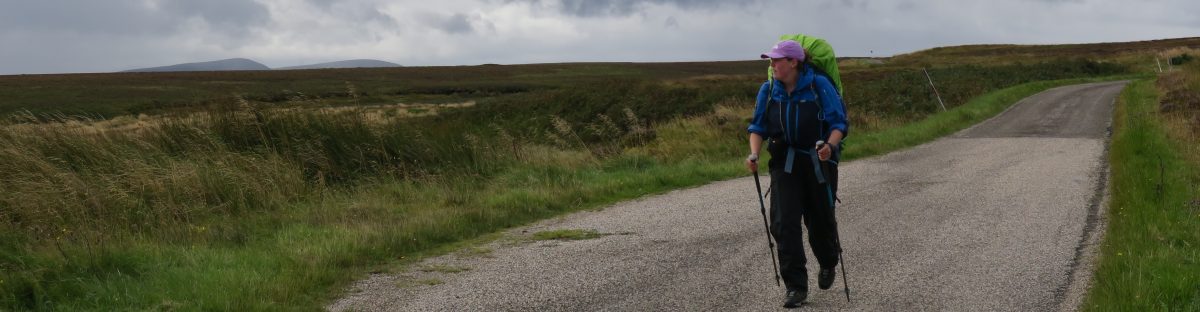
The rest of the day was moor and then my first experience of large sections of forest where it was surprisingly boggy underfoot. I thought that the vast swathes of trees would soak up every molecule of water, but alas it appears there is just too much water in these parts and so I got very wet feet having opted for trainers – mainly just because I could!

As I was reaching the point where I had agreed to meet my dad I looked at my watch and saw that I was 5mins early, that’s pretty good timing I thought and it’s no time at all to wait. I continued down the path approaching the lane when the car appeared and just as I climbed over the stile my dad arrived alongside it, so I opened the door and leapt in – A-Team style! We were gobsmacked by the perfection. It was extraordinary that we arrived at the exact same spot at the exact same time.

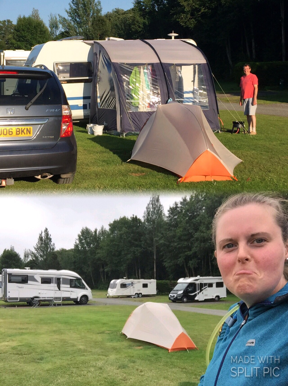
Tonight was my parents’ last night and mine with the extra home comforts – we played cards and had some brandy.

  • Day: 61 – Wednesday 18th July
  • Started at: Willowbog, nr Stonehaugh
  • Finished at: Bellingham
  • Miles: 7
  • Miles from LE: 740.5
  • Duration: 3.5hrs (10:15-13:45)
  • Trig points visited: 0
  • Ales imbibed: 0

I’d arranged to stay an extra night at the campsite sans caravan so all I had to do after being dropped off was walk the 7miles back to the campsite. It was a slightly teary goodbye and I waved my parents off down the lane. Farewell comfy pillow, goodbye clean non-hiking clothes, cheerio well rounded meals and packed lunches, au revoir Dusty (the dog) oh yeah and ciao mum and dad!

It was a fairly uninteresting 7miles but I did find a ‘Pit Stop’ for Pennine Way walkers. Little signs and arrows pointed you in the direction of a former stable building that had been transformed into a hikers haven/treasure trove. It had seats, snacks, drinks in the fridge, a kettle plus accoutrements, toilet and shower, washing machine and tumble dryer (these may have just been the owners’), oh and a little box of hiker goodies – a spare guidebook, plasters etc. As it happened I didn’t really need anything, but I could have done with something similar many a time. Such generosity from the owner to let hikers hang out in their barn – love it. It got me thinking; why haven’t I seen more hospitality based on honesty? Perhaps it’s just too much effort.

Pit Stop
Pit Stop

The other small piece of drama was coming across an injured sheep. It had a wound on its back leg that had attracted flies and it wouldn’t walk – it just stood there no matter how close I got, I could even stroke it. I took a note of the number on its ear tag and reported it to the next house I came to. Hopefully the girl I spoke to managed to find the farmer and it’s been looked after.

Got back to the campsite in time for lunch and spent the rest of the day chilling out in the campers lounge and getting myself ready to head off again.


No more support crew!

  • Day: 62 – Thursday 19th July
  • Started at: Bellingham
  • Finished at: Forest View Walkers Inn, Byrness
  • Miles: 16
  • Miles from LE: 756.5
  • Duration: 8hrs (9:00-17:00)
  • Trig points visited: 0
  • Ales imbibed: 1.5x Thirsty Walker – Forest View Walkers Inn Ale

After setting off from Bellingham, heading through a farmyard, getting chased down by a dog and hitting the moors again, I found a number of other Pennine walkers. There was a South African lady who’d walked from Chepstow for charity and was joined by a friend, Greg an Australian chap who likes coming to the UK to do the long distance trails and a group of 3 more Australians (father and 2 sons).

Nothing much else happened so here is a picture of a sheep with massive horns. I’ve seen A LOT of sheep since Land’s End – tens of thousands – and this one has the biggest horns by far.

A fine specimen - although not sure how much it could see
A fine specimen – although not sure how much it could see

At around lunch time I met Claire another Pennine wayfarer. Then it was a long trudge down a forest road which I hated. There were a few lorries that barrelled along them too – without slowing – which was lovely of them. I kept myself going until I reached the edge of the forest where there were picnic benches. I was going to treat myself to a long sit down, boots off ‘n’ all. But as soon as I sat down the midges attacked. They put a very quick end to my plans and so I picked up my heavy bag and carried on grumpily. I could definitely feel the full weight being back on my back.

Forest track with lorries

My destination was the Forest View Walkers Inn and I’d arranged to camp in the back garden for free provided I bought a 2 course dinner and had breakfast. At £22 it was a good deal as there weren’t any shops or restaurants in Byrness. It was here that I’d meet everyone that I’d seen on the trail today plus a few others who were staying a second night. (The last day of the Pennine Way is 28miles which is too far for most people so Joyce and Colin have a minibus to pick walkers up halfway to Kirk Yetholm at the end of day 1 and then drop them back the next morning.) One of those with just 1 day left was Dom who I’d met on day 50 (over 2 weeks ago) – how we’d not crossed paths in the interim I have no idea. (Hi Dom if you’re reading! Hope you enjoyed you’re free half pint in KY!) The inn was fantastically sociable with everyone sharing experiences and comparing notes, plus spirits were high as everyone had only 1 or 2 days left. The hand pumps in the corner of the living room helped! As did Colin’s many tales of walkers he’d seen pass through his doors.

Just another note on the Walkers Inn – not only were Joyce and Colin lovely and interesting hosts, the food was great, the beer was good, and everything was clean and tidy. But here’s the clincher – the drying room! Not only did it work but when each walker arrived Colin would take your boots from you, take out the insoles and number with chalk both the boots and the insoles. He’d then prioritise the wettest boots and rotate them around the rack accordingly. In the morning, once they were all dry, they were paired up and brought into the conservatory for everyone to slip on…now that’s service!

  • Day: 63 – Friday 20th July
  • Started at: Forest View Walkers Inn, Byrness
  • Finished at: Dere Street nr Shibden Hill
  • Miles: 13
  • Miles from LE: 769.5
  • Duration: 7.75hrs (9:15-17:00)
  • Trig points visited: 0
  • Ales imbibed: 0

Last day on the Pennine Way – I had to make a note on my map of where to turn off so I didn’t end up going towards Kirk Yetholm. I set off with Greg straight up Byrness Hill which is a steep and slippery muddy bank.

View from Byrness Hill

Once atop the moors we met a few more walkers and we eventually caught up with Claire. We passed by Chew Green – a significant Roman Fort complex – and not long after I turned left off the Pennine Way and across the border into Scotland!

I've walked to Scotland - yay!
I’ve walked to Scotland – yay!

I waved goodbye to my companions and on my own again I got a little bit emotional; “little ol’ me has walked 750+miles across the length of her own country”.

I had  lunch at the top of Blackhall Hill staring into the land of haggis, whiskey, tartan and Mel Gibson in a kilt. As I descended I looked around and the landscape definitely seemed different. There were lots of interesting lumps, bumps and humps and I was philosophising over whether I thought it was different because I knew it was a different country or whether if I’d been ignorant to the border would I notice a change? Either way I could definitely sense a change, even if it was just mentally and emotionally.

The change in scenery - I love the textures
The change in scenery – I love the textures

I was now walking along Dere Street which is a Roman road built well before Hadrian built his wall. It runs from York to Edinburgh and I’d be walking it for the rest of the day until I found a wild camping spot. The border did signify a game changer – I could now legally wild camp almost anywhere, which makes the planning a bit easier. No campsites? No worries, just stock up on food, refill water from a stream and I’m good to go wild camping anywhere. I had my eye on a particular hill and getting closer I started looking for spots. When Dere Street met a lane there was a bench on a flat-ish area of grass. Looking ahead, the hill I’d seen on the map was nothing like reality. The area of woodland had been felled, the walls/fences had been removed and it was littered with cows and sheep. The area by the bench would be more than sufficient so I stopped there and then. It was only 5pm so I didn’t pitch up, instead I wrote my diary, did some stretching and sat upon my bench. The lane was very quiet, only 1 or 2 cars an hour or so, that was until no less than five 4x4s came screeching to a halt right alongside me and turned my tranquil spot into a car park. Well I was fuming, “who the bloody hell are this lot and what do they think they’re doing just parking all over my abode?” Then Tony Robinson got out, and all was forgiven! He was with a TV crew and they’d arrived to do some filming on Dere Street for a series called Ancient Tracks. Once he’d heard about what I was doing there, he came over, shook my hand, congratulated me and posed for a photo. I spent a good hour or so talking to various members of the crew (who gave me 2 bottles of water and a banana) and before I knew it they were gone again. What a surreal moment!

Me and Sir Tony
Me and Sir Tony

It was only later on that I found out he’s Sir Anthony and I’d never met a knight before. It was probably a good thing I didn’t know beforehand because I wasn’t able to string a sentence together anyway, let alone come up with some quip about a cunning plan. So had I known I might’ve panic curtsied or something!

Once they’d gone I cooked my dinner, sat on my bench to watch the sunset and reflected upon an event filled day.

Sunset from Dere Street

Pennine Way Part 2

  • Day: 54 – Monday 10th July
  • Started at: Usha Gap, Muker
  • Finished at: Tan Hill Inn
  • Miles: 7
  • Miles from LE: 651.5
  • Duration: 4.25hrs (10:30-14:45)
  • Trig points visited: 0
  • Ales imbibed: 2x Tan Hill Ale

There was an air of excitement as I packed up and left the 100s of midges behind. My parents had travelled up with the caravan from East Sussex to be my support crew for 10 days and we arranged to meet at the Tan Hill Inn. Which meant, well, bliss. A super light day bag, no worries about accommodation, no thoughts about where my next meal would come from or how I might imaginatively cook it on my stove, and I’d put in a request for some extra clothes, a proper pillow and a nice fluffy towel – a respite from microfibre!

I opted to take a path that was not the Pennine Way – gasp – but seeing the Way unnecessarily climb and fall on the opposite side of the river I felt vindicated as I only had a gentle rise onto the moors. Once up there it rained on and off so I sheltered in a cow-‘ause for my lunch. With less than 5miles to go, I had to consciously slow myself down as I knew the earliest my parents would be able to get there was 4pm and I’d call them when I arrived to let them know I’d made it.

My excitement at reaching Tan Hill Inn

The inn – which at 530m is the highest in England and possibly one of the remotest – is a popular spot for walkers, cyclist and bikers as it offers camping, bunkhouse and B&B accommodation. Plus it remains open in the foulest weather even when they’ve been snowed in for weeks they still welcome visitors. As I reached for the door handle I spotted a handwritten sign stuck to the window which read; “Due to an issue with the water supply we have had to close, sorry for any inconvenience”. Well, I nearly cried, but the porch was open so I resigned myself to waiting there. Then a guy came over, unlocked the door and said; “we’ve taken pity on you, come on in and sit by the fire and dry yourself off!”. I was so grateful for the warmth but pushed my luck by asking if the hand pumps still worked and they did! I supped my beer and steamed by the fire as the staff ate their lunch and I gleaned more information about the issue. Then the landlady appeared and asked the staff to begin a deep clean – they may as well make the best of a bad situation. Meanwhile the phone was constantly going; the message had gone out and those with bookings were calling to find out more or just complain. Amidst the melee someone left the door unlocked and so customers kept letting themselves in – despite the sign; a group of 4, a couple, another 3, another couple. The landlady was sat by the door and welcomed each patron with a smile and the same line; “we are officially closed as we don’t have any water, so you can’t use the toilets and you can’t have tea or coffee. But if you’d like an effing drink, you can pour it your-effing-self or eff off!!”. So that is just what they did, they went behind the bar, found a glass and pulled their own pints. It was absolute joyous chaos and provided great entertainment whilst I waited for my parents to arrive.

When they did, there were hugs and a few tears. I pulled us some drinks and we caught up. Then it was back to the campsite where I’d be pitched for 5 whole nights.

  • Day: 55 – Tuesday 11th July
  • Started at: Tan Hill Inn
  • Finished at: Wythes Hill, B6276
  • Miles: 14
  • Miles from LE: 665.5
  • Duration: 6.75hrs (10:45-17:30)
  • Trig points visited: 0
  • Ales imbibed: 0 (but a G&T and a glass of wine instead!)

After a very relaxing evening in the caravan, one of mum’s home-cooked lasagnas, a G&T and a glass of wine it was back to Tan Hill in the morning for the walk across Sleightholme Moor. With only a day pack I felt like I was flying, it was great!

It's so light!
It’s so light!

Somehow Allan – with a hand he pack – caught up with me, he was walking the Pennine Way as part of his PTSD therapy and raising money for a veteran’s charity having served in the army for 17yrs +. We walked and chatted, crossed under the busy A66 and continued across the moors. At a cairn I stopped for lunch and Allan decided that was him done for the day so he pitched his tent. Another couple of walkers caught up – John and John who I’d met in the Tan Hill the day before.

Shortly before the arranged pick up point there were a couple of nature reserves. One was ‘Hannah’s Meadows’ named after Hannah Hauxwell who farmed there using such simple methods that rare flower species thrive and it is now designated an SSSI. I recommend the original documentary from the 1970s called ‘Too Long a Winter’ and its sequel ‘A Winter Too Many’ about her frugal life on the farm (both are on YouTube). I had a peaceful moment in a hide looking over the reservoir; 2 oystercatchers, a heron, a gull and lots of sheep.

View from the hide
View from the hide

In the evening dad cooked a BBQ and one of my best friends; Emma happened to be in Penrith for work and she was able to drive over for some of my dad’s charred sausages. It was a great surprise and a bit of a shock to the system to suddenly be surrounded by friends and family – I’m not used to so much conversation and having to verbalise my thoughts.

Me and Emma
Me and Emma
  • Day: 56 – Wednesday 12th July
  • Started at: Wythes Hill, B6276
  • Finished at: Langdon Beck YHA
  • Miles: 11
  • Miles from LE: 676.5
  • Duration: 6.5hrs (10:00-16:30)
  • Trig points visited: 0
  • Ales imbibed: 1x Rivet Catcher

Today my dad was going to join me for a large part of the day but first I had to get up over a hill and down in to Middleton-in-Teesdale. The 2.5 miles took over the estimated hour because I had binoculars and so was distracted by the many birds plus I dropped my map and had to go back about 1/4mile to find it. I found my parents at the coffee shop and then me and dad waved goodbye to mum and set off along the Tees. It was a lovely walk along the dale through meadows and copses, plus it was perfect walking weather. We passed by Low Force and High Force where there were many more walkers but out the other side of the attractions we were back to having the trail and the juniper trees (with gin berries) to ourselves.

Low Force
Low Force
High Force
High Force

It was a short climb at the end of the day up to Langdon Beck YHA and dad was pleased to see mum and the car. He had now completed 0.7% of LEJOG but didn’t think he could tackle the remaining 99.3!

Me and Dad
Me and Dad
  • Day: 57 – Friday 14th July
  • Started at: Langdon Beck YHA
  • Finished at: Dufton
  • Miles: 12.5
  • Miles from LE: 689
  • Duration: 5.75hrs (9:45-15:30)
  • Trig points visited: 0
  • Ales imbibed: 1x Ruskin’s

Yesterday we had a day off and went to Richmond for some gear shopping and lunch.

Then in the morning it was back to Langdon Beck for the walk over the Tees, along a beck to Cauldron Snout Waterfall (which you need to scramble up the side of so I was very glad for the small, light bag), then on to High Cup Nick and down to Dufton.

Cauldron Snout
Cauldron Snout

I’d never heard of High Cup Nick before but I think it will stick in my memory forever. Coming from the south, you come from a narrow-ish river valley. As it opens up you walk across the plain and then wham! you’re stood at the top of a band of rock that surrounds this huge bowl-like feature with views to the Lake District. Absolutely stunning.

High Cup Nick

  • Day: 58 – Saturday 15th July
  • Started at: Dufton
  • Finished at: Garrigill
  • Miles: 15.5
  • Miles from LE: 704.5
  • Duration: 7.5hrs (9:30-17:00)
  • Trig points visited: Cross Fell, 893m – NY687343
  • Ales imbibed: 0.5x Angel Ale

Today I was going to reach 893m – higher than I’d been so far and higher than I would get for the rest of the trip – even in Scotland. I did a sun dance but unfortunately I must have been communicating with the low mist and cloud god. After an hour of ascending towards Green Fell I went into the cloud and could only see about 20-30m around me. It stayed this way until an hour before reaching Garrigill when I descended out of the cloud. This weather made for some great photos…!

Little Dun Fell

Great Dun Fell – there is a giant radome in that cloud somewhere


Cross Fell

I appreciated the use of Greg’s Hut as a respite from the wind and rain whilst I had my lunch. I expected to find other wayfarers settled in for the night having decided not to continue battling through the weather, but I had it to myself. The final 6.5miles down the old corpse road were grim and hard on the feet – again I was glad I didn’t have the full pack.


Greg’s Hut

Whilst I was out on the hills my parents moved base camp from Barnard Castle up to Bellingham.

  • Day: 59 – Sunday 16th July
  • Started at: Garrigill
  • Finished at: Haltwhistle Station
  • Miles: 17
  • Miles from LE: 721.5
  • Duration: 8hrs (9:00-17:00)
  • Trig points visited: 0
  • Ales imbibed: 1x Wey Aye Pale Ale (this is not me being derogatory about being in the North West, this was the name of the ale)

It was a special day today because I had arranged to meet Ronnie and Julie (see days 8 and 38) who were going to join me for half a day of walking. We met in Garrigill and the weather was much improved – perhaps my sun dance had got stuck in an outbox.

We walked the Pennine Way up to Alston where they bought me coffee and cake and then we continued along the railway line, which was not all disused – it had steam trains running along part of it – and it was unlike many other railways lines. It was not completely straight, flat, tarmacked and enclosed, instead it was refreshingly open with nice views. We talked for hours, sharing tales of the places we had stayed. Our differing experiences of the same places were usually dependent on the weather at the time. At 3pm Ronnie and Julie turned around to walk the 12miles back to Garrigill – a 24mile day(!) – and I continued to Haltwhistle (a mere 5 extra miles) . Their parting gift was a small plastic pop bottle filled with whiskey, a very thoughtful present.


Ronnie, Julie and me

A brief Rockhopping interlude

  • Day: Saturday 8th July
  • Started at: West Burton
  • Finished at: West Burton
  • Miles: 17.5
  • Miles from LE: 634.5
  • Duration: 9.5hrs (9:30-19:00)
  • Trig points visited: Buckden Pike, 702m – SD960788
  • Ales imbibed: 1x Copper Dragon, 1x Askrigg Ale

Rikki the Rockhopper and Fury the mini Schnauzer puppy picked me up on Friday as planned and drove us to the campsite. It felt like a fast way to travel, the hedges zoomed by the window and the view changed remarkably quickly.

Fury...awwwww!
Fury…awwwww!

On the Saturday morning all the other small tents had popped up overnight and once we’d agreed a route we set off. Having only a day bag I felt like I could gallop along. Ahh such relief. From West Burton we reached the top of the ridge at Height of Hazeley with ease and added some mileage by wandering around looking for a dropped camera, which we never found. Then it was on to Brown Haw and eventually Buckden Pike along the ridge line which was a pathless, tussocky, bog slog.

I have friends!
I have friends!

From Buckden Pike we picked up a footpath and eventually a track which led us down to farmland. About 100 stiles later we were back at West Burton and it would’ve been rude not to walk past the pub and not stop.

So I’d done a tough 17.5 mile walk and got no closer to John O’Groats…! Hmm.

  • Day: 53 – Sunday 9th July
  • Started at: Hawes
  • Finished at: Usha Gap, Muker
  • Miles: 10
  • Miles from LE: 644.5
  • Duration: 6.75hrs (10.30-17:15)
  • Trig points visited: Great Shunner Fell, 716m – SD848973
  • Ales imbibed: 0

Today I was back to heading in a line due north. Chris the Rockhopper had also been suitably knackered by the previous day’s walk and so offered to take me back to Hawes and then walk with me for the first mile and a half to Hardraw Force – at 98ft it’s the highest single drop waterfall in England. Entrance is through a pub which is novel and it was quite impressive but I’m not sure about £2.50 impressive.

Me and Chris at Hardraw Force

After this I was back on my own again for the trudge up Great Shunner Fell – the guidebook had warned me about the false summits but at the 10th I was getting a bit bored of thinking I was nearly at the top so just forgot about it and marched on. By the time I got to the top the cloud and mist had rolled in and I couldn’t see very far but it was a uncharacteristically dry mist. I’ll take that!

Atop Great Shunner Fell with
Atop Great Shunner Fell with “extensive views”

On the way down, the sun came out and by the time I got to the pretty little village of Thwaite I was roasting so it was a good job the tea room was open. There was less than a kilometre left so I hauled on my pack, ambled down to the campsite and pitched up in a lovely riverside spot.

Pennine Way Part 1

  • Day: 50 – Tuesday 4th July
  • Started at: Squirrel Wood, Cowling
  • Finished at: Malham YHA
  • Miles: 17.5
  • Miles from LE: 608.5
  • Duration: 10hrs (8:30-18:30)
  • Trig points visited: Pinhaw Beacon, 388m – SD944472
  • Ales imbibed: 0.5x Wainwright

I left promptly as I knew I had a long day ahead of me and was looking forward to getting to the picturesque village of Malham and a night in the youth hostel. Soon after rising out of Cowling the drizzle began but I reached Lothersdale in good time. Unfortunately I was too early for the nice looking pub – it was only 10am! So I continued on climbing upwards; deeper into the cloud. Reached Pinhaw Beacon and enjoyed the spectacular view – not!

Me looking cheery at Pinhaw Beacon

By the time I got to Thornton-in-Craven I was pretty damp and my boots hard started to squelch. This village is crying out for a pub but unfortunately lacks one so a bench would have to suffice (during a brief pause in the rain) where I changed my socks. Just before reaching East Marton – and it’s pub! – there was a short stretch alongside the Liverpool to Leeds canal which included the double arch bridge. An odd feature that can’t be explained.

The double arch bridge

Unfortunately the pub lacked a fire or warm radiator – it was actually almost chilly inside – but what it lacked in warmth it made up for with a delicious steak sandwich. Once I was mostly dry apart from my socks and boots I stepped back out into the rain and promptly slipped down the stone steps back onto the towpath. Luckily no damage done. On arriving in Gargrave and being presented with a tearoom I flexed my will power and managed to walk straight on by – there were still a lot of miles to go today.

Having noted that the route crossed numerous fields (with saturated grass) I opted to continue along a track and cut back across just one field. Part way along my phone pinged and it was a photo from my dad of my mum enjoying the glorious warm sunshine back home in the garden. This tipped me over the edge and I burst into tears – “It’s not fair! Why can’t the sun come out here? What am I doing? This is miserable. I too could be sat at home enjoying the sunshine, instead I’m trudging through the rain. Was this whole LEJOG thing such a good idea?”. I rejoined the route and was quickly met by another walker and just about kept myself together as we introduced ourselves. This was Connor, on day 5 of walking the Pennine Way, a student who’d just competed his first year studying physics at Cambridge and as I would find out over the next couple of days was into ultra-light backpacking, that, and his brain is the size of a planet! He could tell me the weight in grams of virtually every item in his bag. (Hi Connor if you’re reading this – hope you’re progressing along the Pennine Way as planned with your very light bag!)

Conversation ensued for the remaining 6miles which made the time pass by much quicker and almost made me forget just how wet my feet were – sort of, although I think the squelching was audible. Walking over the crest of a hill and seeing Malham Cove looming in the distance, gave me a new appreciation of its sheer scale and uniqueness – that’s a moment I won’t forget.

First glimpse of Malham Cove

In Malham, Connor headed to a campsite, I went towards the YHA and as I approached I dreamed of a very efficient drying room – it’s the small things! On inspection it seemed adequate and I practically deposited all of my belongings in there. In the kitchen I met Jane and Mark who are also walking LEJOG (that’s 9 others now)! Their journey had a different feel; there was no camping so their bags were very light and they were walking a much more direct line through larger places. Unfortunately they are also going to have to cut their trip short, at the Scottish border, due to family circumstances. (Hi Jane and Mark if you’re reading this – hope you enjoyed the rest of the Pennine leg and are able to return later in the year to conquer Scotland!)

  • Day: 51 – Wednesday 5th July
  • Started at: Malham YHA
  • Finished at: Horton-in-Ribblesdale
  • Miles: 12.5
  • Miles from LE: 621
  • Duration: 7.5hrs (8:30-16:00)
  • Trig points visited: 0
  • Ales imbibed: 1x Ingleborough Ale

The hostel was rammed full of year 6 kids who had booked breakfast for 8am and so the vast majority of the hostel patrons were rushing to breakfast between 7:30 & 8:00. I saw Jane and Mark again and we swapped blog addresses before I departed.

The first leg of the walk was to wander down to Malham Cove, climb the staircase and clamber across the limestone pavement at the top. Looking back I could see others starting to trickle out of Malham but as it was still relatively early I was alone on the top, that was until Connor’s head popped up from the last step. I couldn’t understand where he’d come from but it was nice to have some company again.

It's quite daunting when you're underneath
It’s quite daunting when you’re underneath

We set off around Malham Tarn and then up over Fountain Fell where, as we descended, we stopped for lunch with a view over the valley to Pen-y-ghent. Even though the cloud was rising off the top I had already made up my mind that I was going to take the more direct route to Horton-in-Ribblesdale. So at a fork in the path we went our separate ways but knew we were staying the in the same (and only) campsite in the middle of Horton, so it wasn’t for long.  Soon after I’d pitched my tent and showered, some cadets arrived and pitched their tents, then more arrived, then more! It made for some rudimentary entertainment to watch the organised chaos of approximately 40 16/17 year olds put up tents, cook dinner and unwind all the while complaining about blisters.(Jasper and Max were also at the campsite in Horton but had taken the bus for today’s leg because they were suffering with blisters.)

The cadets setting up camp
  • Day: 52 – Thursday 6th July
  • Started at: Horton-in-Ribblesdale
  • Finished at: Hawes
  • Miles: 13.5
  • Miles from LE: 634.5
  • Duration: 6.75hrs (9:45-16:30)
  • Trig points visited: 0
  • Ales imbibed: 1.5x Lightfoot Ale

When I poked my head out of the tent in the morning all the cadets had packed up and gone without making enough sound to rouse me – couldn’t believe it!

Without much in the way of food and with the well known Pen-y-ghent cafe / tourist information / shop / Yorkshire three peaks challenge check in/out post en route I decided to head there for breakfast. And who should I find waiting outside for it to open…Connor! After I’d watched him drink a pint of hot chocolate – none of this grande, venti nonsense, it was small or a pint when it came to hot drinks – we set off for Hawes.

Today’s walking was fairly unremarkable as it was along old packhorse ways – gradually uphill for the morning and then downhill for the afternoon. However what was remarkable was that at some point in the day I passed the halfway point! 600miles down, 600 to go. When I realised this I was on Birkwith Moor which unfortunately lacked a champagne bar so I merely stopped, through my arms aloft, whooped and then continued.
The second half of the day we were a group of 4 – we had caught up with Jasper and Max.

Route over an old bridge at Ling Gill

Once in Hawes I was celebrating reaching the halfway point with a pint outside one of the many many public houses on offer when Jane and Mark walked by. They joined me and even bought me a drink, and we shared stories of our walking experiences. The campsite was 1km out of Hawes so I had to drag myself away from the pub and go and get my tent set up and dinner cooked etc.

Sunset at Hawes
Sunset at Hawes

The following day was to be a rest day – eating lots of cheese courtesy of the Wensleydale cheese factory and waiting. Waiting for what? Well the Rockhoppers (the mountaineering club of which I am a member) just happen to have a trip booked on the same weekend in the same valley, just 10miles from me. So I’d arranged to meet with them for the weekend and do some more walking – in a circle for a change. I must be mad!

The rest of the Peaks, into Yorkshire and onto the Pennine Way

Please excuse this brief but rambling entry – I’ve just jotted down some notes to catch up!

  • Day: 45 – Thursday 29th June
  • Started at: Strines Inn, Bradfield Dale
  • Finished at: Dog and Partridge, Flouch
  • Miles: 12.5
  • Miles from LE: 544.5
  • Duration: 7hrs (9:30-16:30)
  • Trig points visited: Back Tor, 538m – SK197909
  • Ales imbibed: 1.5x Deception

Having had the best night’s sleep of the trip it was hard to drag myself out from under the fluffy down duvet and out into the rain again – hence the slightly late start! Today was proper moorland walking with plenty of grouse (and shooting of said grouse). I was worried when I flushed them out that they would get shot straight back down again! Luckily that didn’t happen. Headed up over Black Tor and Lost Lad for the stunning panoramic views.

Me atop Black Tor
Me atop Black Tor

Got some relief from the rain alongside the reservoirs – which were noticeably low, so I suppose we need the rain. Rose above the reservoirs and experienced the first of the peat groughs – a sign of things to come me thinks. Reached the Dog & Partridge almost dry but still appreciated the open fire in the bar. Another hot bath awaited me which was lovely. Got talking to the landlord over dinner and he kindly bought me a beer.

  • Day: 46 – Friday 30th June
  • Started at: Dog and Partridge, Flouch
  • Finished at: Wild Camp nr Marsden
  • Miles: 14
  • Miles from LE: 558.5
  • Duration: 9hrs (9:00-18:00)
  • Trig points visited: South Nab, 461m – SE156003
  • Ales imbibed: 0

Left via South Nab and as I started to descend and leave the main road behind me, a man pulled up in his Land Rover. He got out and started heading down the slope in my direction, shouting loudly and rapidly “HEY, HEY, HEY…”. I was slightly disconcerted but I knew I was on access land so the fact that I wasn’t on the right of way shouldn’t have been a problem and I don’t think he was trying to warn me. I glanced over a couple of times but his call didn’t change. I decided to keep my head down and just keep going to see what happened. The penny finally dropped when I realised he was rounding up his sheep and it had nothing to do with me. Phew!

After a rest in the pub at Holme it started raining again and a ‘shortcut’ I opted to take actually turned out to be harder work and drenched my feet – you win some, you lose some! I got to Wessenden Head and the prospect of another 6 miles or so was not appetising (including a 2 mile diversion to a campsite that would have to be retraced in the morning). I had enough provisions for a wild camp so that’s just what I did. I stopped above Butterley Reservoir on a disused bridge and I basked in the 5 mins of evening sun that poked through the cloud.

Wild camping spot
Wild camping spot
  • Day: 47 – Saturday 1st July
  • Started at: Wild Camp nr Marsden
  • Finished at: Aaron’s Campsite nr Cragg Vale
  • Miles: 12.5
  • Miles from LE: 571
  • Duration: 9hrs (8:30-17:30)
  • Trig points visited: Manshead End, 417m – SD997197
  • Ales imbibed: 0

Packed up an almost dry tent after a windy night but slept better than usual. Walked straight down into Marsden for a breakfast of avocado and poached egg on toast – scrummy! Passed by more reservoirs (they scatter the landscape around here – something I’ve never noticed before having not spent any significant time up t’north). When the sun came out I just stopped where I was, spread my wet things out and basked on a rock for 30mins. It felt so good! Manshead Hill loomed over but it wasn’t a painful climb – listening to Hakuna Matata and singing along at the top of my voice I actually bounced up the hill. The views from the top were extensive and stunning. I think I could see Leeds and the Ferrybridge Power Station which is 30 miles away as the crow flies.

View from Manshead Hill

Finished up at Aaron’s campsite; a bit basic – no hot water or showers and quite windy but it’ll do me.

  • Day: 48 – Sunday 2nd July
  • Started at: Aaron’s Campsite nr Cragg Vale
  • Finished at: Hebden Bridge
  • Miles: 4.5
  • Miles from LE: 575.5
  • Duration: 2hrs (11:00-13:00)
  • Trig points visited: 0
  • Ales imbibed: 1x Clive – the ‘Breakfast IPA’, 1x Wainwright

The campsite was a few miles from Hebden Bridge and I had maps waiting for me but as it was a Sunday the Post Office would be closed. I decided to walk into HB to cover those few miles, spend the rest of the day in the town, get the bus back to the campsite and then get the bus straight to the PO first thing Monday morning – are you still following?!

I bounced along with just a day bag and was glad to be unladen as the going was very steep, with complicated path networks and very squidgy bog on the top. As I crossed the moor an owl popped up which was a brief but exciting wildlife encounter. I descended into HB and it was buzzing. It turned out there was a street performance festival, a market and lots of things to see.

Hebden Bridge Street Performers

The sun was shining and I soaked up the atmosphere and the rays. A perfect day topped off with a Sunday roast including an authentic Yorkshire pudding.

Aaron's Farm Sunset
Aaron’s Farm Sunset


  • Day: 49 – Monday 3rd July
  • Started at: Hebden Bridge
  • Finished at: Squirrel Wood, Cowling
  • Miles: 15.5
  • Miles from LE: 591
  • Duration: 9.75hrs (10:45-20:00)
  • Trig points visited: 0
  • Ales imbibed: 0

Due to bus timetable alterations the first bus was at 10am – hence the late start. I headed due north alongside rivers and enjoyed the flowing water and dappled shade from the trees. At a decision point the guidebook said ‘go left to take the road via the pub or continue up the riverside to take the direct route which joins up with the Pennine Way’. I opted to continue along the river – WRONG DECISION. The path rapidly became vague, the gorge got steeper and the terrain more precarious. I was scrambling over slippery moss covered rocks, between overgrown vegetation, ducking under low hanging trees, climbing over fallen trees and hating every step. I should have turned back but I got stuck in the mentality of; “I’ve come this far, I think I can see the end, I’ll just keep going”. I got scared, and moments from the book/film ‘127 hours’ were flashing through my mind. I could have easily slipped and fallen awkwardly and with it being so remote, no-one would come through here any time soon. After I fell and grazed my thumb I became angry at the guidebook for suggesting this route, I became angry at myself for persisting and I became angry at the time and energy I was losing. I eventually got to the end where the valley opened up and met a track. I sat on the tarmac and cried with relief. It was easily the worst hour of the trip so far and could’ve have been a lot worse. I’m not clear whether I had strayed from the path or not but either way it was a bit of a wake up call and a reminder to listen to alarm bells. If it doesn’t feel right, just turn back.

Initially the riverside was lovely

After I’d patched myself up and had something to eat I headed onto the Pennine Way (which I would now follow for the next 190 miles). Immediately there were walkers ahead and walkers behind and I felt reassured. I overtook 2 young-ish lads; Jasper and Max who I would see numerous times over the next few days and headed up over the moorland via Top Withins – the apparent inspiration for Heathcliff’s house in Wuthering Heights. I descended into Cowling late and exhausted. The campsite was very pleasant; basically someone’s back garden and the shower was delightfully hot. I ‘cooked’ some Super Noodles and flopped into bed.

Not a vehicle track...it's Pennine Way dual carriageway! Top Withins is on the horizon.
Not a vehicle track…it’s Pennine Way dual carriageway! Top Withins is on the horizon.
singtowerhamlets.wordpress.com/

Making a joyful noise in the heart of London's east end

Nature watching in South Devon

By an amateur ecologist and professional enthusiast

Carpe Diem

A retirement blog